

2014 Trip Blog,
August
(speedo 30,015 klm)
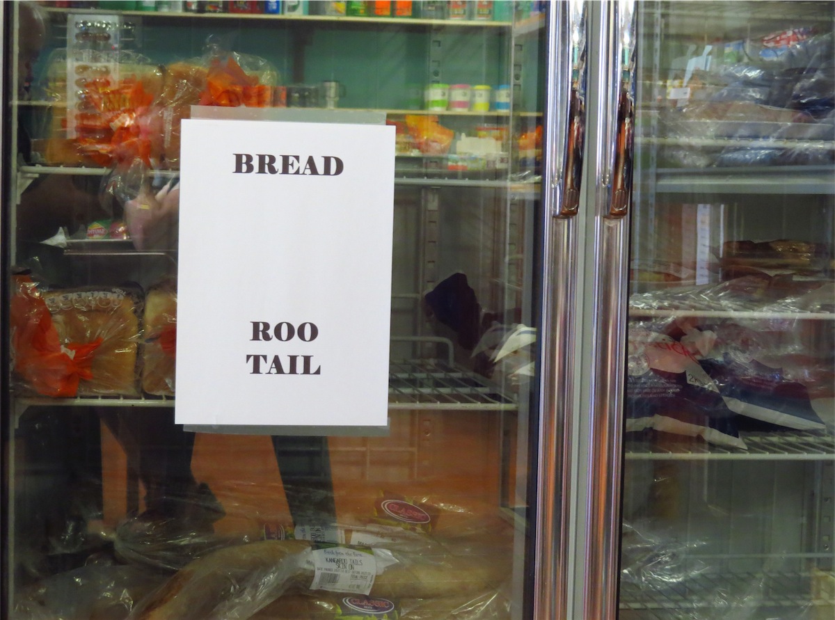
Friday 1st August, Cue, WA
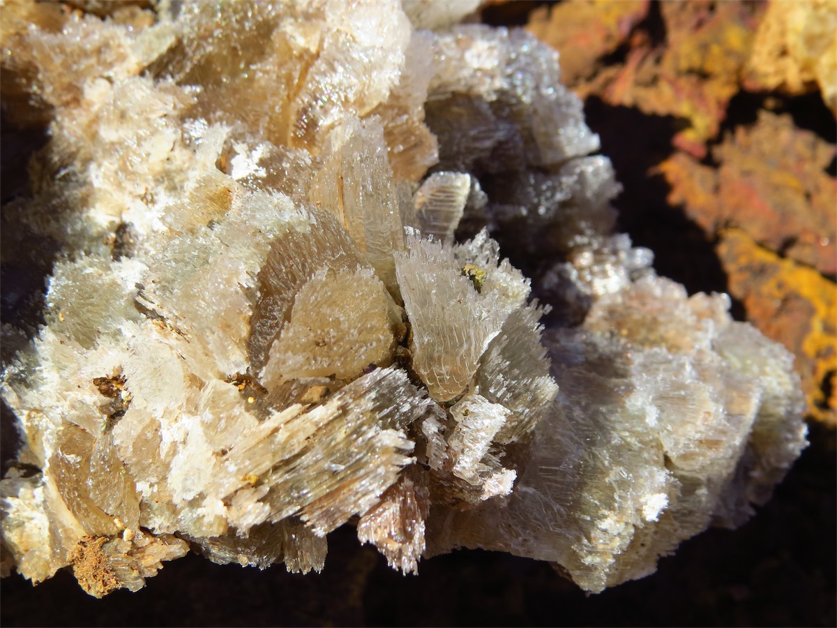
Don could hardly move this morning but he did have a smile on his face. Four new tyres were on the truck. He was very glad to have a 'rest day’ before starting his three day course tomorrow to learn the secrets of metal detecting. He’s had his for about ten years and has not had any 'eureka moments', so he decided to get all the facts and ‘give it a go’ whilst we are up this way. We have never been really serious detectors but maybe that will change with all his new-found knowledge. We’ll never, never know, if we don’t have a go. Plus it’s a great excuse to wander about the Goldfields Country, a fantastic part of Western Australia.
Saturday 2nd August, Cue, WA
First day of the Course and Don came home very impressed. I was happily surprised, as on Don’s scale of dislikes attending a Course is probably close to the top. It was a long day, from 0830 to 1730 which comprises a lot of new stuff to take in and can be very tiring but Don arrived back at Camp with a smile and enthusiastic to go back tomorrow. This was a good outcome.
Monday 5th August, Cue, WA
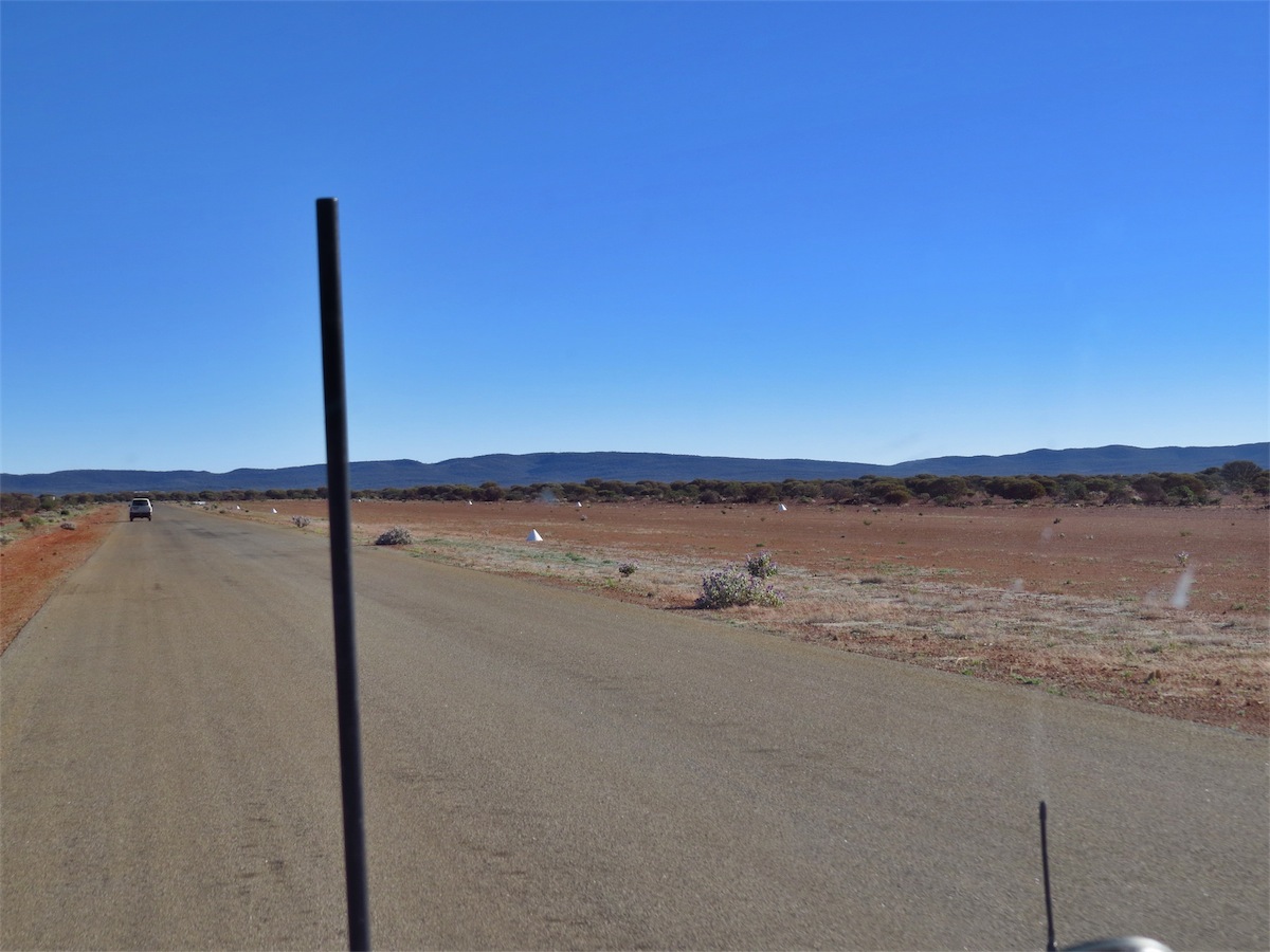
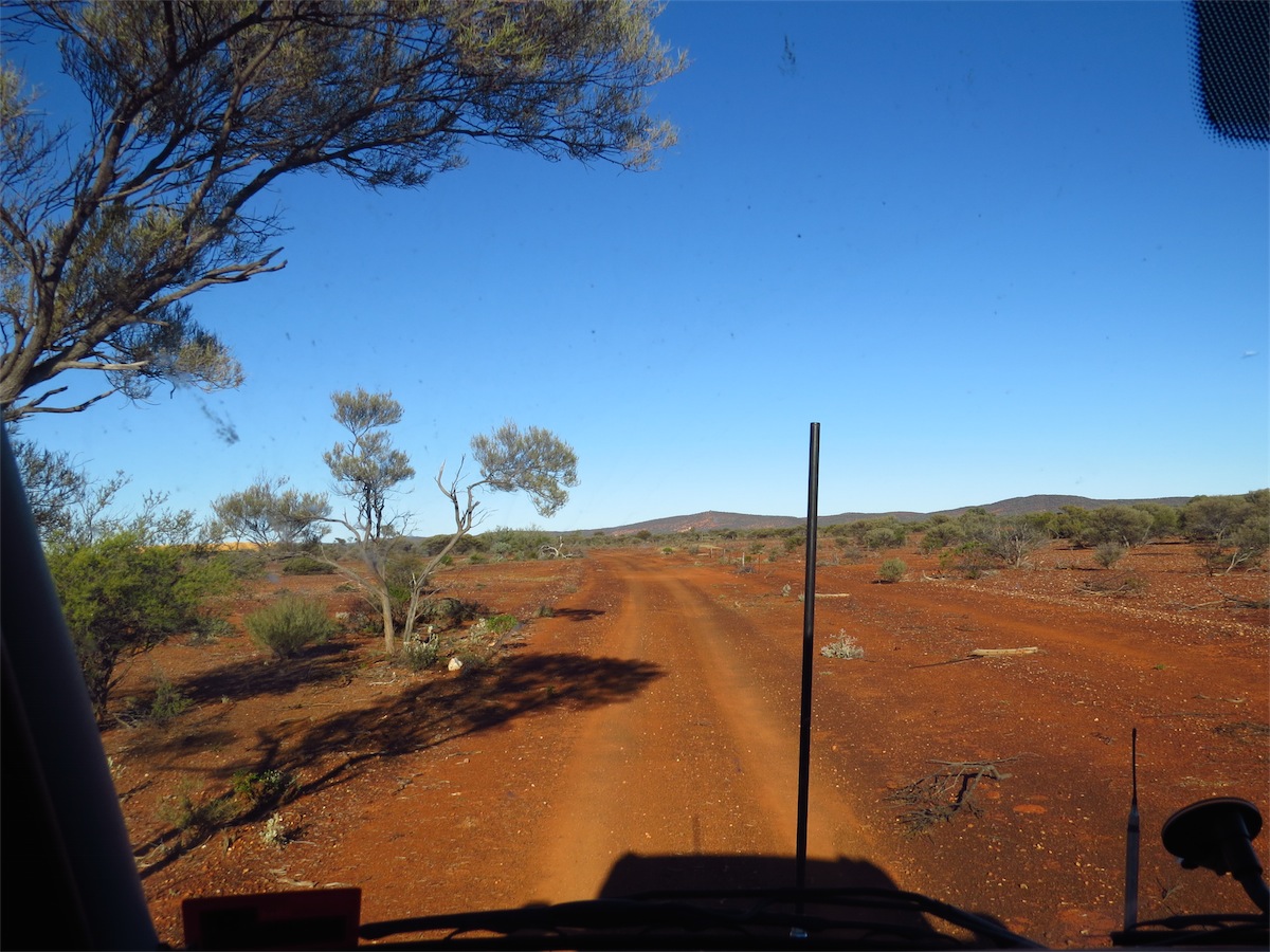
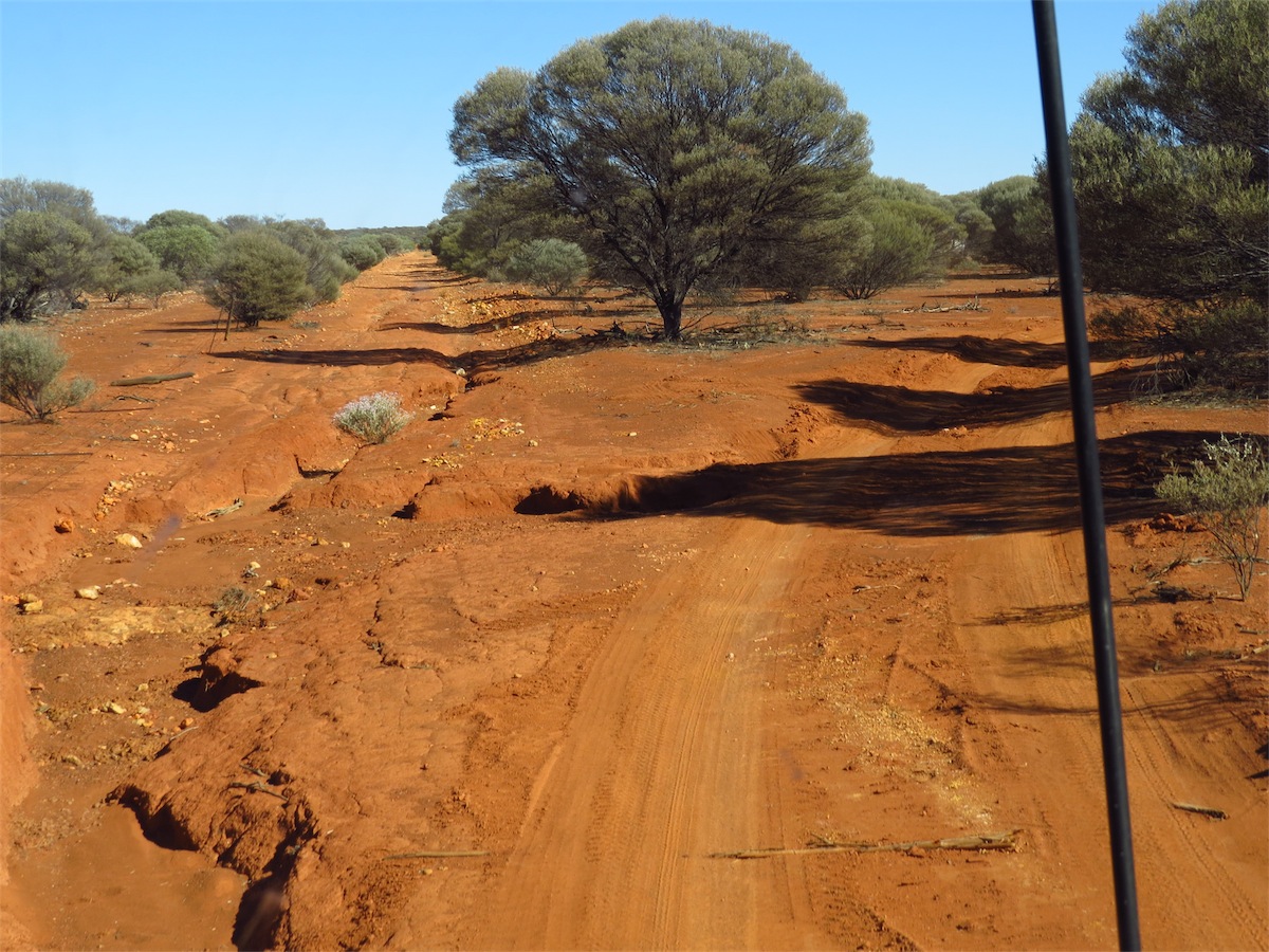
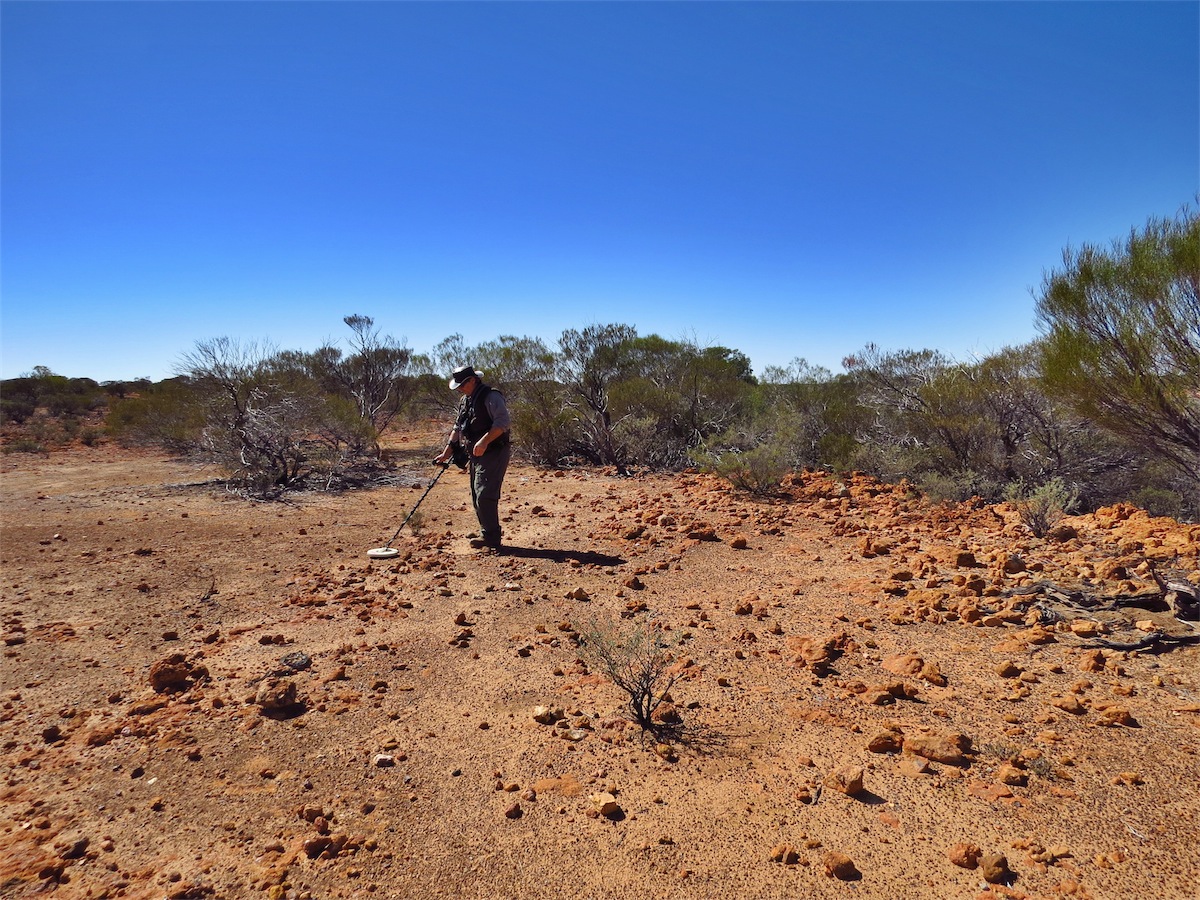
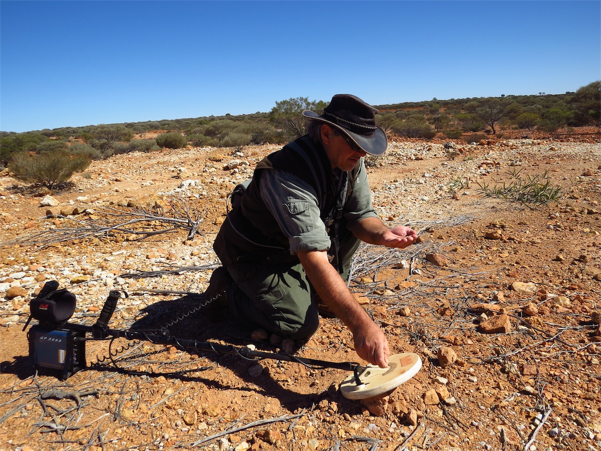
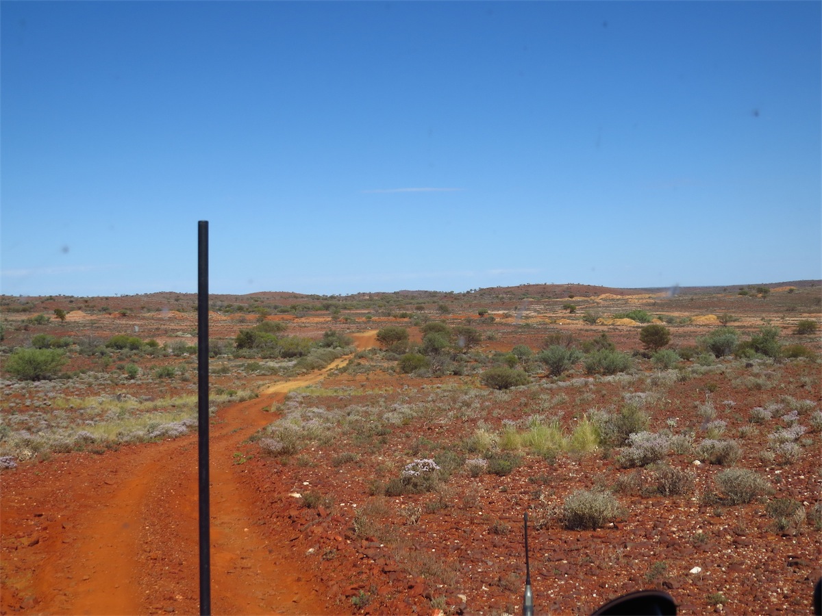
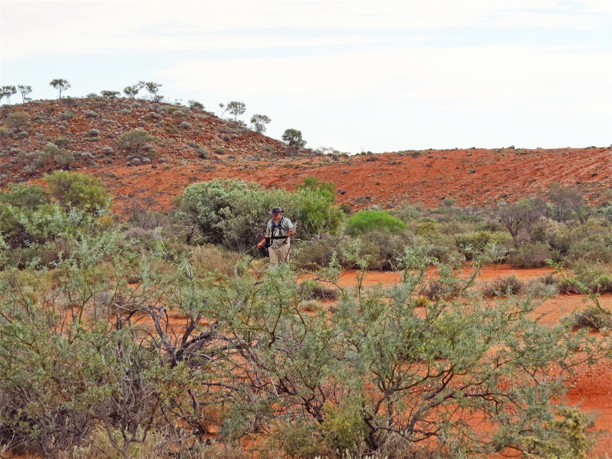
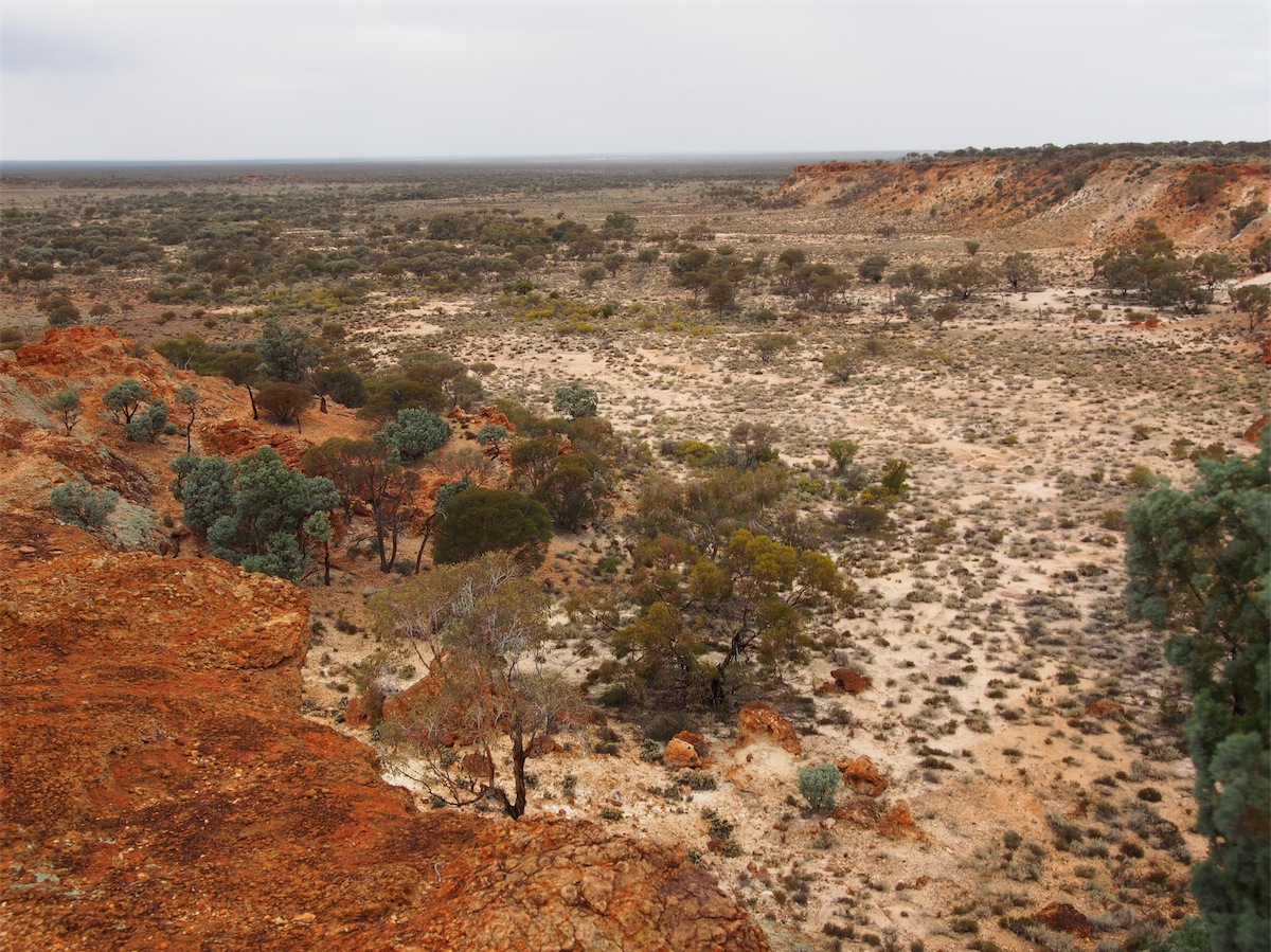
We were up early this morning, it was the last day of Don’s Detecting Course. Today consisted of a Field Trip in which family members were allowed to attend so it was great that I could accompany him. Our destination was on a working Leasehold about 80kms NE of Cue.The first 70kms was on a sealed road, compliments of the Mining Companies in the area with the last 10kms on a dirt track, quite rough in patches with deep ruts and erosions but easily navigable.
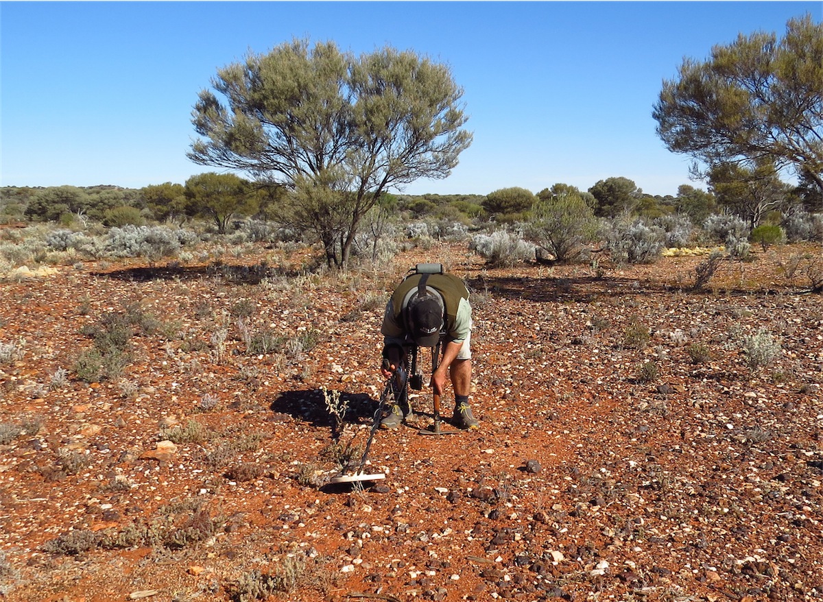
This was a well-worked site and pickings of the shallow surface gold was getting slim, so luck was not with us today as far as ‘striking it rich’ went but the benefits of being able to experience and compare the different Detectors and the knowledge gained on knowing how to manipulate and program the correct settings and calibrate the ground balance was well-worth it.
In the past, Don and I had a Detector each but going off in different directions for hours was not how we wanted to spend our time, so we ditched one of them and I now ‘carry the pick, dig the holes and fill them in after we have dug up the nail or the bullet or the horseshoe’. Apart from the fact that it’s far more awkward for Don to do the pick-work with the Detector harness strapped to his back, I actually enjoy doing it. It also means that we are together and don’t have to worry about whether the other person is lost, fallen down a mine-shaft or been bitten by a snake.
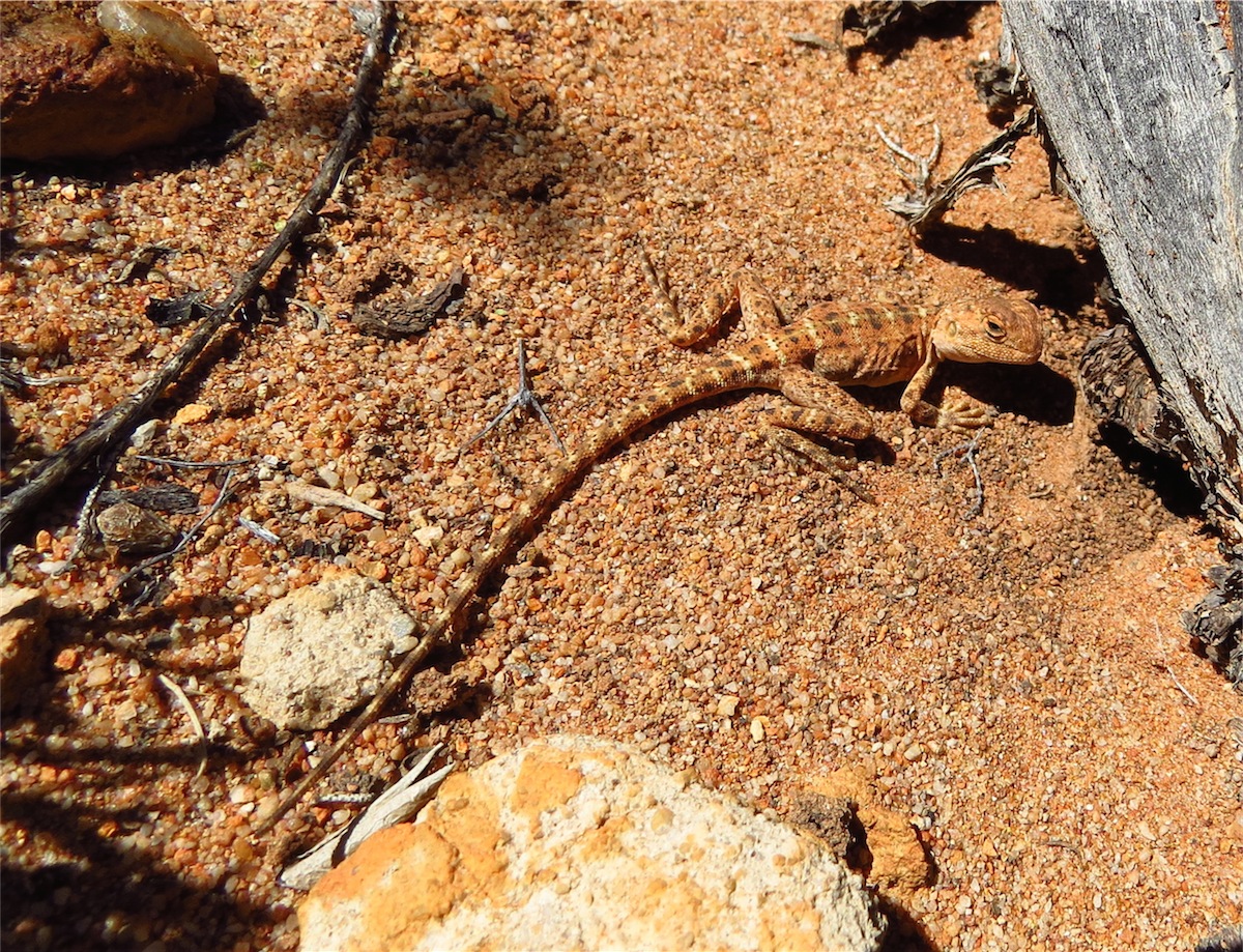
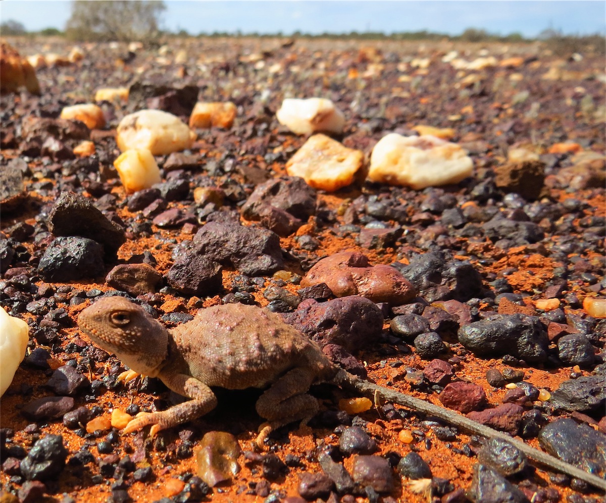
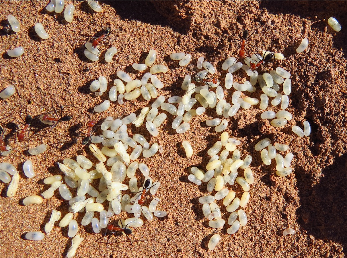
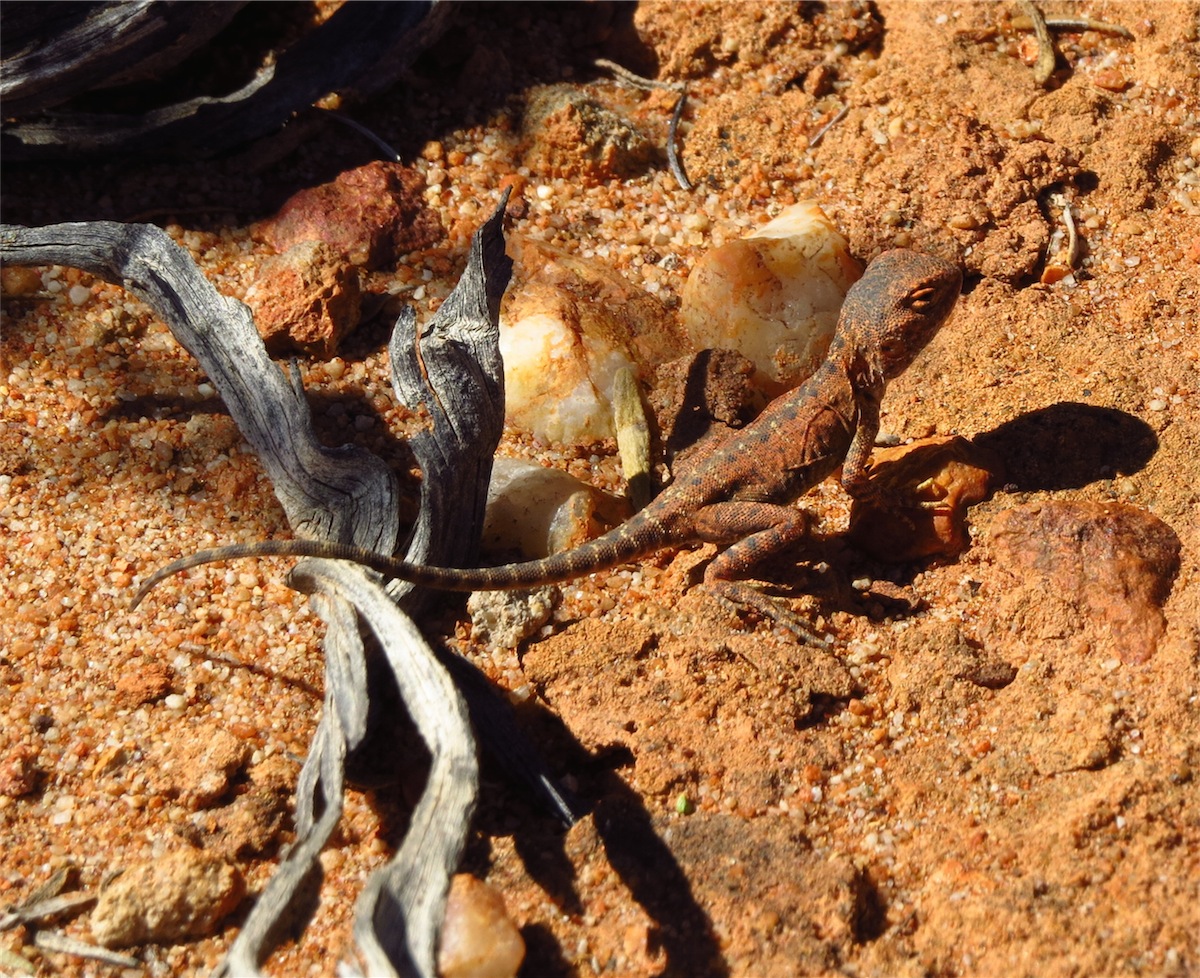 The day was not totally without ‘gold’ though. We came across two tiny dragons, only feet apart, of different species. This is not
uncommon but we haven’t seen two so close together before. Their camouflage is quite incredible. They keep quite still when
sunning themselves, turning their heads now and again as if to check you out, so its possible to get a good photo if you get close
enough. Once on the move though, there is no hope, they dart about with incredible speed. These little guys were so tiny, we
were lucky to spot them.
The day was not totally without ‘gold’ though. We came across two tiny dragons, only feet apart, of different species. This is not
uncommon but we haven’t seen two so close together before. Their camouflage is quite incredible. They keep quite still when
sunning themselves, turning their heads now and again as if to check you out, so its possible to get a good photo if you get close
enough. Once on the move though, there is no hope, they dart about with incredible speed. These little guys were so tiny, we
were lucky to spot them.
 We tried detecting in different areas, down rocky escarpments, in sandy creek beds and through the flat, stoney under-brush. We
were not disappointed when we found only a couple of bullets, a few nails and a tin can. There is always next time. The landscape
was beautiful, the sun warm on our backs and the company perfect. How could we have been disappointed!
We tried detecting in different areas, down rocky escarpments, in sandy creek beds and through the flat, stoney under-brush. We
were not disappointed when we found only a couple of bullets, a few nails and a tin can. There is always next time. The landscape
was beautiful, the sun warm on our backs and the company perfect. How could we have been disappointed!
Even though Don unfortunately is suffering from some nasty bug that’s grabbed hold of him, we had both enjoyed today immensely but when it came time to call it a day, Don didn’t waste any time packing up and heading back to Camp. It had been a long day, especially being a physical one when he was feeling so miserable. Not once though, did I hear him complain. It became apparent how crook he felt, when not long after finishing dinner he laid down on the bed fully clothed, not even taking time to take his eyes out. He was completely exhausted. It was only 1900. For once I got to be ‘the boss’ and did all the ‘securing camp jobs’, packing up, locking the truck, etc..
Don usually bounces back fairly quickly so I’m confident with a good night’s sleep he will be feeling much better tomorrow.
Wednesday 13th August, Cue, WA
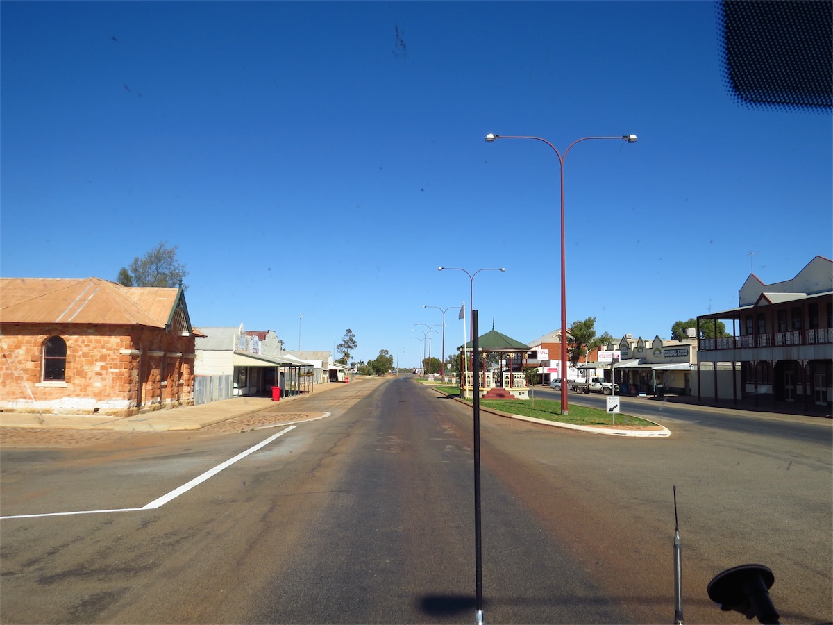
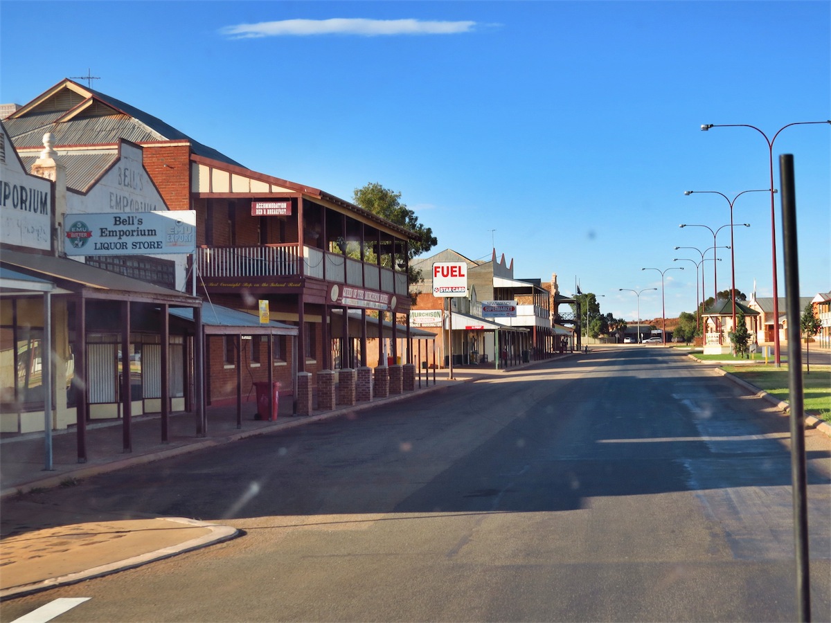
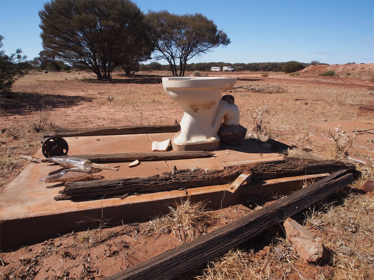
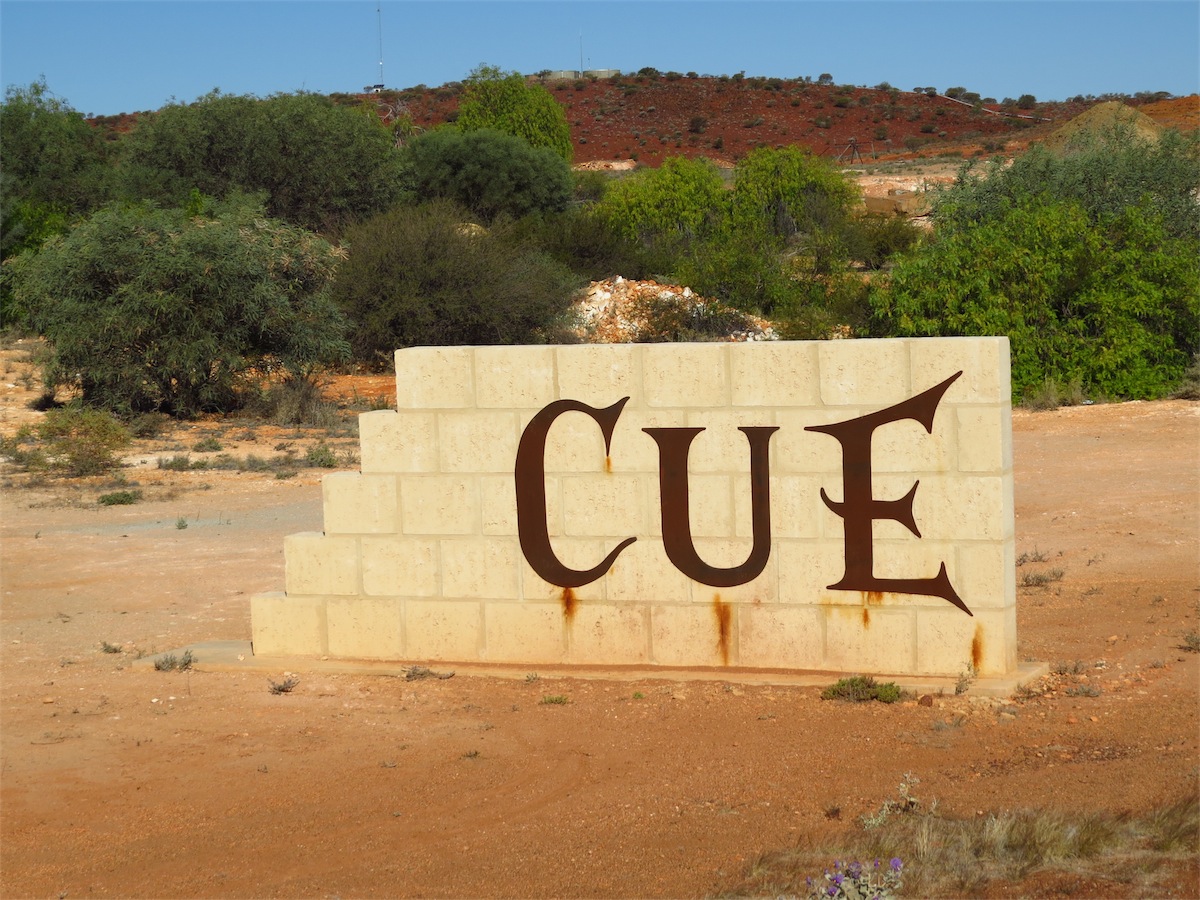 Today’s Blog is a wrap-up of our two weeks here in Cue. It is a great historical area with plenty of interesting
places to explore.
Today’s Blog is a wrap-up of our two weeks here in Cue. It is a great historical area with plenty of interesting
places to explore. The Main Street of Cue is very quiet with very little activity, either vehicular or pedestrian. Large transports pass through the town on a regular basis but the Truck Stop is located at the BP Roadhouse on the Southern end of town and although usually busy with a number of triple Road Train drivers refuelling their trucks and themselves, this activity is away from the Main Street.


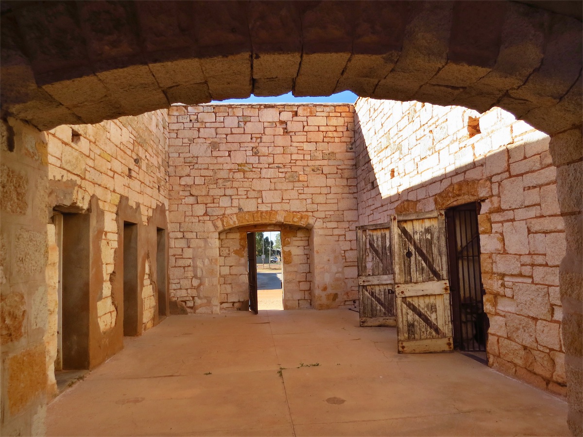
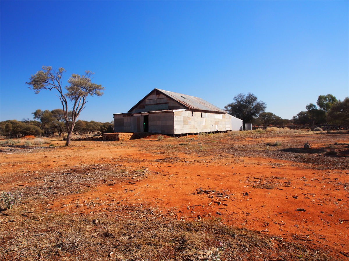
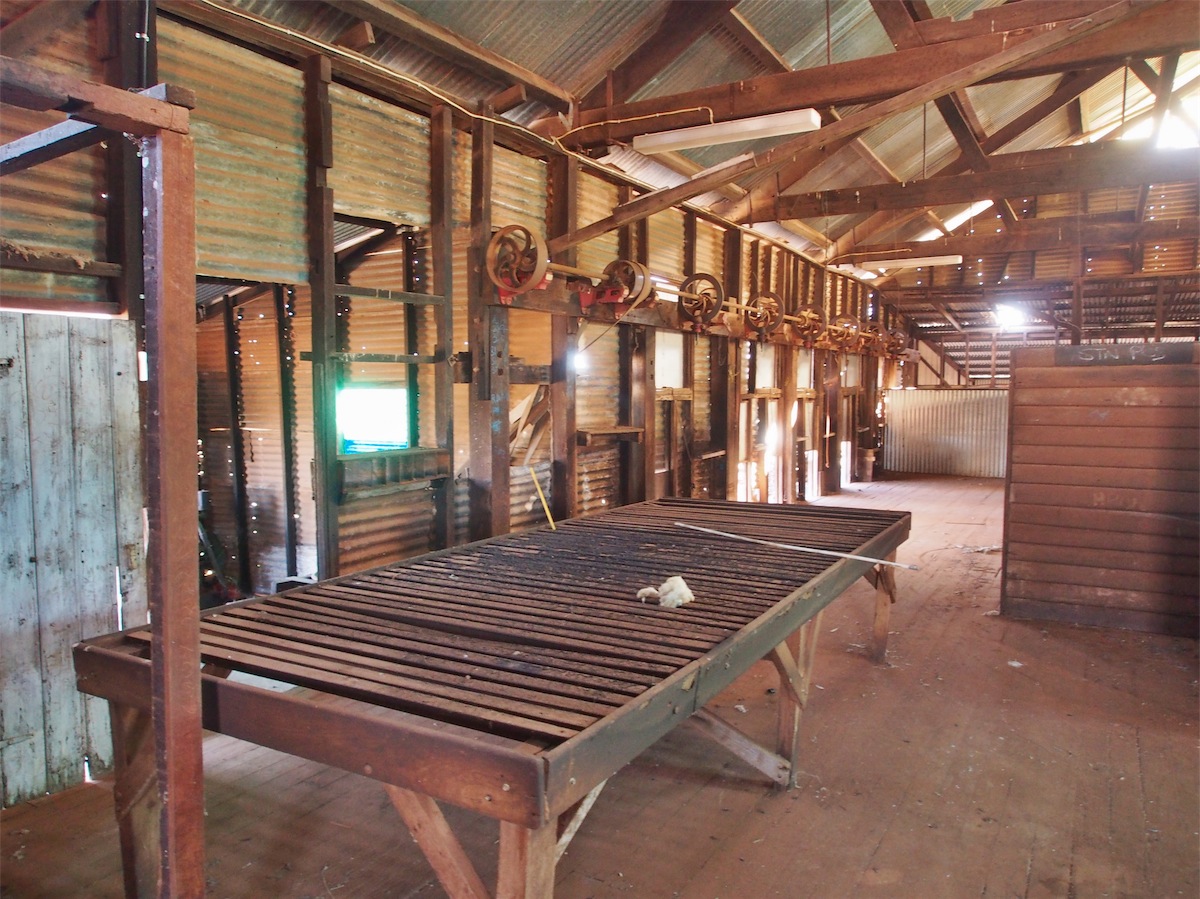
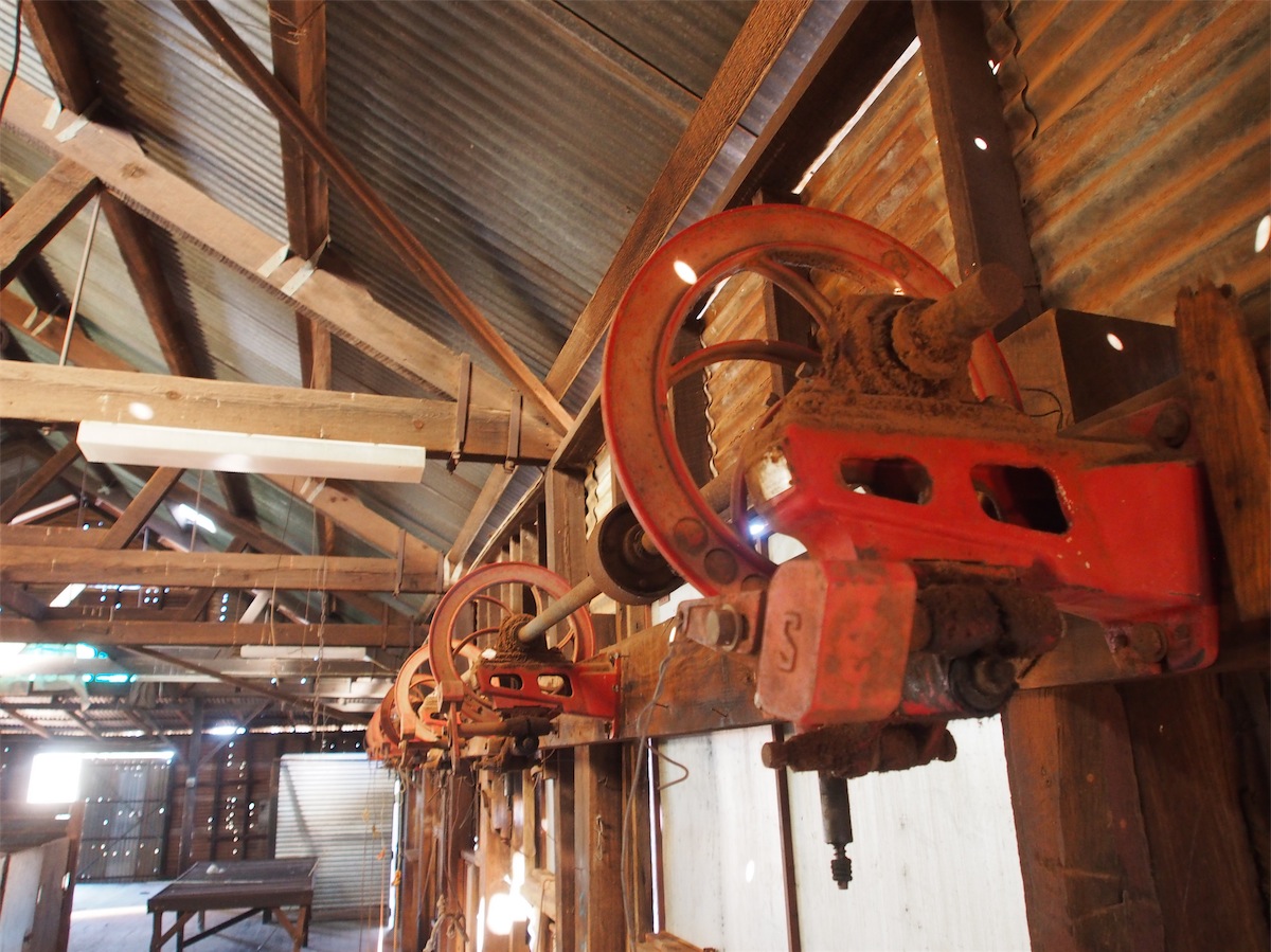
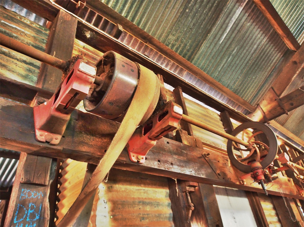
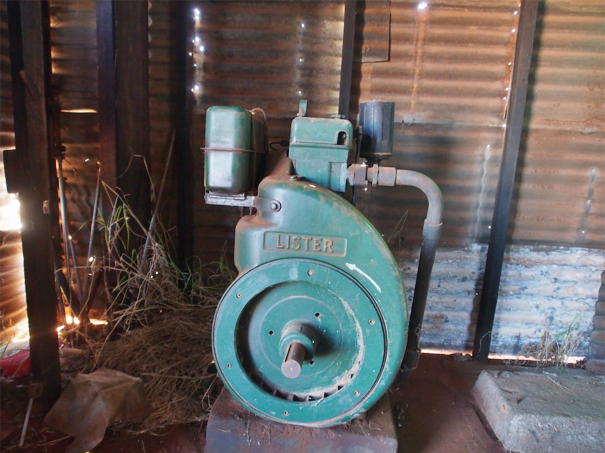
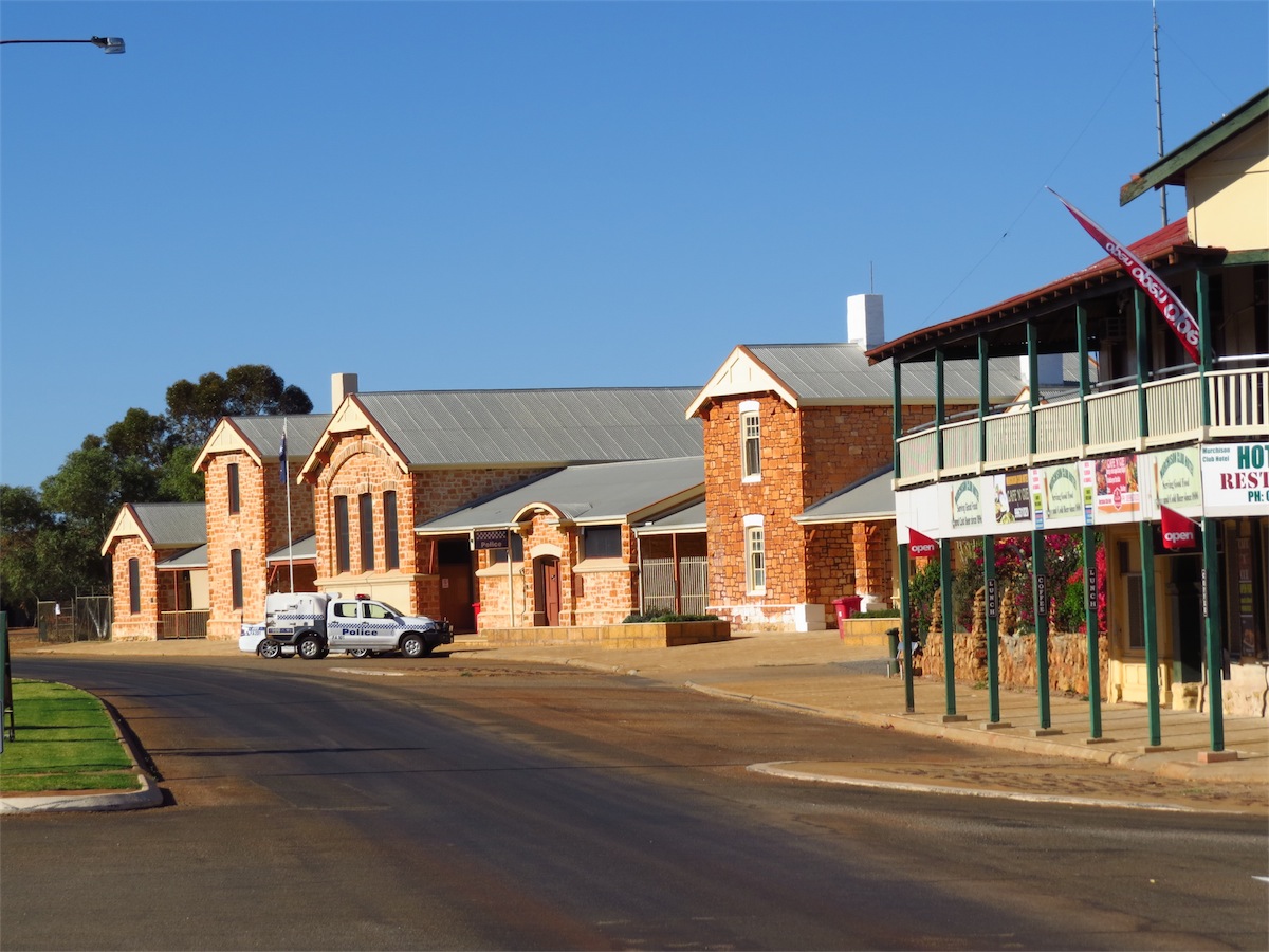 The township of Cue was gazetted in 1893 after the discovery of gold in the area. The Police Station is housed in one
of the original old stone buildings. The actual Gaol was set apart from the Police Station and is located within the site of
the current Caravan Park where it can be openly accessed. There are many historical buildings and areas that we have
yet to explore in and around Cue.
The township of Cue was gazetted in 1893 after the discovery of gold in the area. The Police Station is housed in one
of the original old stone buildings. The actual Gaol was set apart from the Police Station and is located within the site of
the current Caravan Park where it can be openly accessed. There are many historical buildings and areas that we have
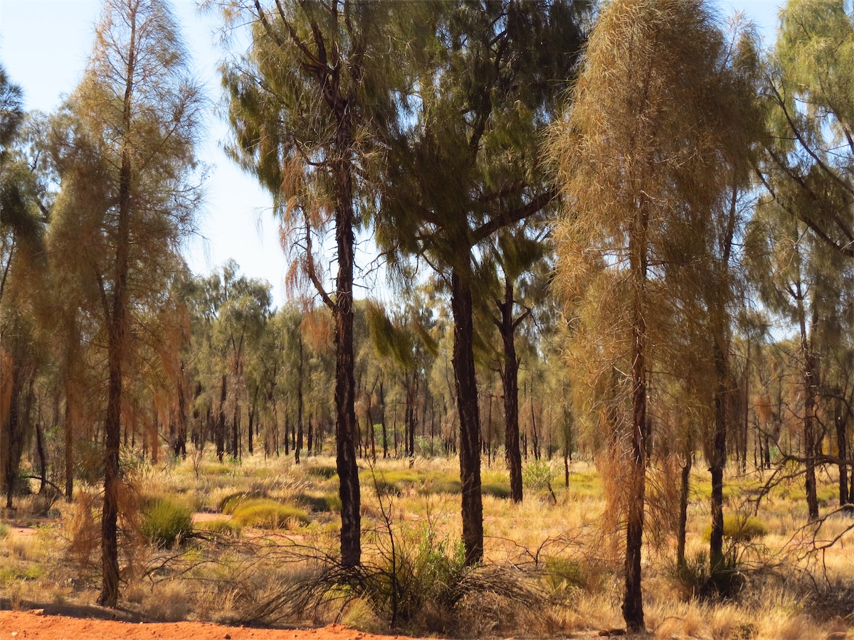
yet to explore in and around Cue.With Don feeling better we were able to get in a few days detecting but with him still NQR, his efforts were kept fairly low-key, though the opportunity to travel out into the goldfield areas doesn’t have to be based on gold detecting. There are so many interesting things to see in these wide open spaces. The hills especially are extremely interesting and relatively easy to climb and once at the top, the 360° views are amazing.
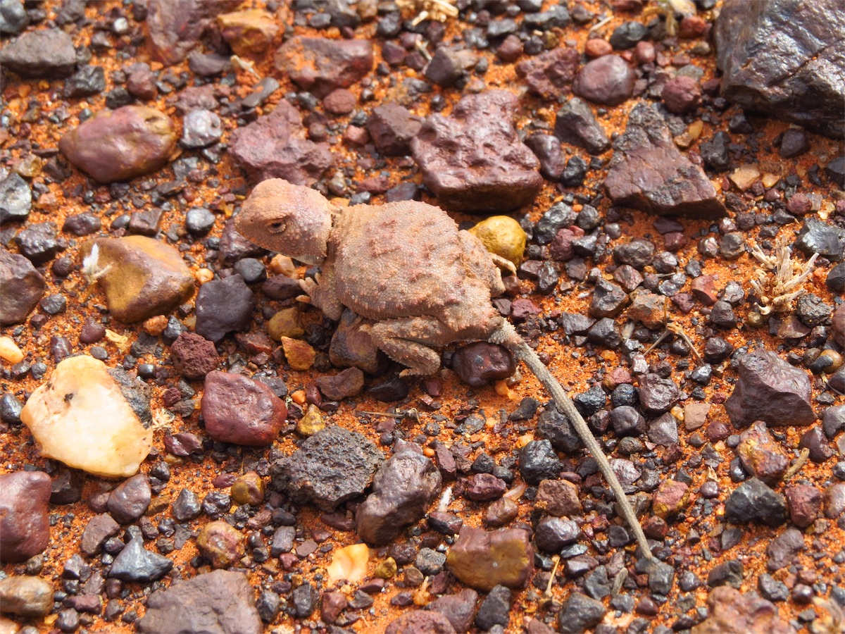
On one of our excursions into the hills we were just heading back to the truck when we spotted a Blotch-Tailed Earless Dragon. This little guy moves mega fast and blends in so completely with the stoney ground that it was only the brief rapid movement that caught my eye. It took quite a few seconds to pinpoint his whereabouts as he sat completely still on the stones and then even more than a few seconds to try and work out just what he was. He sat hunched up like a frog, moved like a mouse and looked like a lizard. It is easy to see him in the photos but from standing height he was almost impossible to pick out from his surroundings. There is very little info on this little creature so I’m not sure how common he is but we have never seen one before. I am still investigating.


 Although the landscape may all look the same at a glance, a vast array of different species of flowers and plants can be seen as you
wander about amongst the scrub. Coming across the various animal tracks is always interesting as is the enormous variety of stones
and rocks that cover the ground.
Although the landscape may all look the same at a glance, a vast array of different species of flowers and plants can be seen as you
wander about amongst the scrub. Coming across the various animal tracks is always interesting as is the enormous variety of stones
and rocks that cover the ground.Tomorrow we are heading off again but with so much still to be explored in Cue and the surrounding areas we will definitely be back this way again.
Thursday 14th August, Bush Camp (Mandaline Well) WA
We headed out from Cue at 0900 and took the road North to Meekathara. We arrived just after 1030 and took the opportunity to hit the local Supermarket for some supplies before turning East on the Goldfields Highway to Wiluna.We only stopped in Wiluna long enough to fuel up then headed up the Gunbarrel Highway for about 15ks where we stopped at a nice little spot for lunch. We continued on up the Gunbarrel then turned SE onto the Barwidgee-Yandal Road just after Woolshed Well.


Friday 15th August, Bush Camp (Jack Well) WA
The morning light is so beautiful in the bush as the sun’s rays slowly creep over the landscape, highlighting the beautiful colours of the bush. The birds chirp and dart about happily and the day slowly comes alive with activity, in total contrast to the stillness of the night.We packed up and were back on the road by 0830 continuing SE to Yandal Station. We passed the Mount Grey Outcamp, which appeared to be in use at the moment, confirmed by the yarding of Cattle corralled further up the track. We arrived at Yandal Station Homestead and were surprised to see that it was abandoned. The Homestead was no longer standing and much of the shedding had been pulled down. We believe Yandal Station is sub-leased by the Barwidgee Station Lessee.


remnants of Yandal Station 1960 Series II 1967 Yamaha Trailblaser 1973 Yamaha AG100
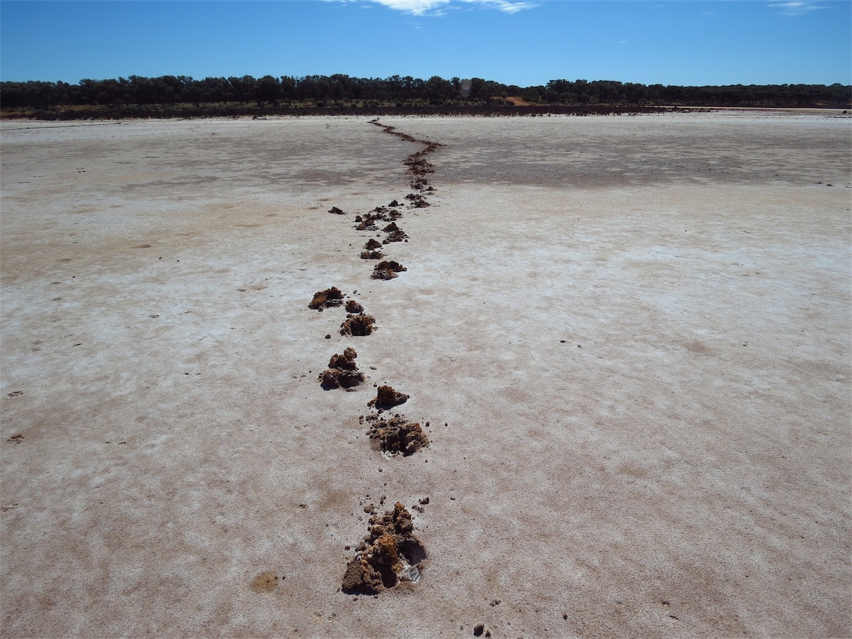
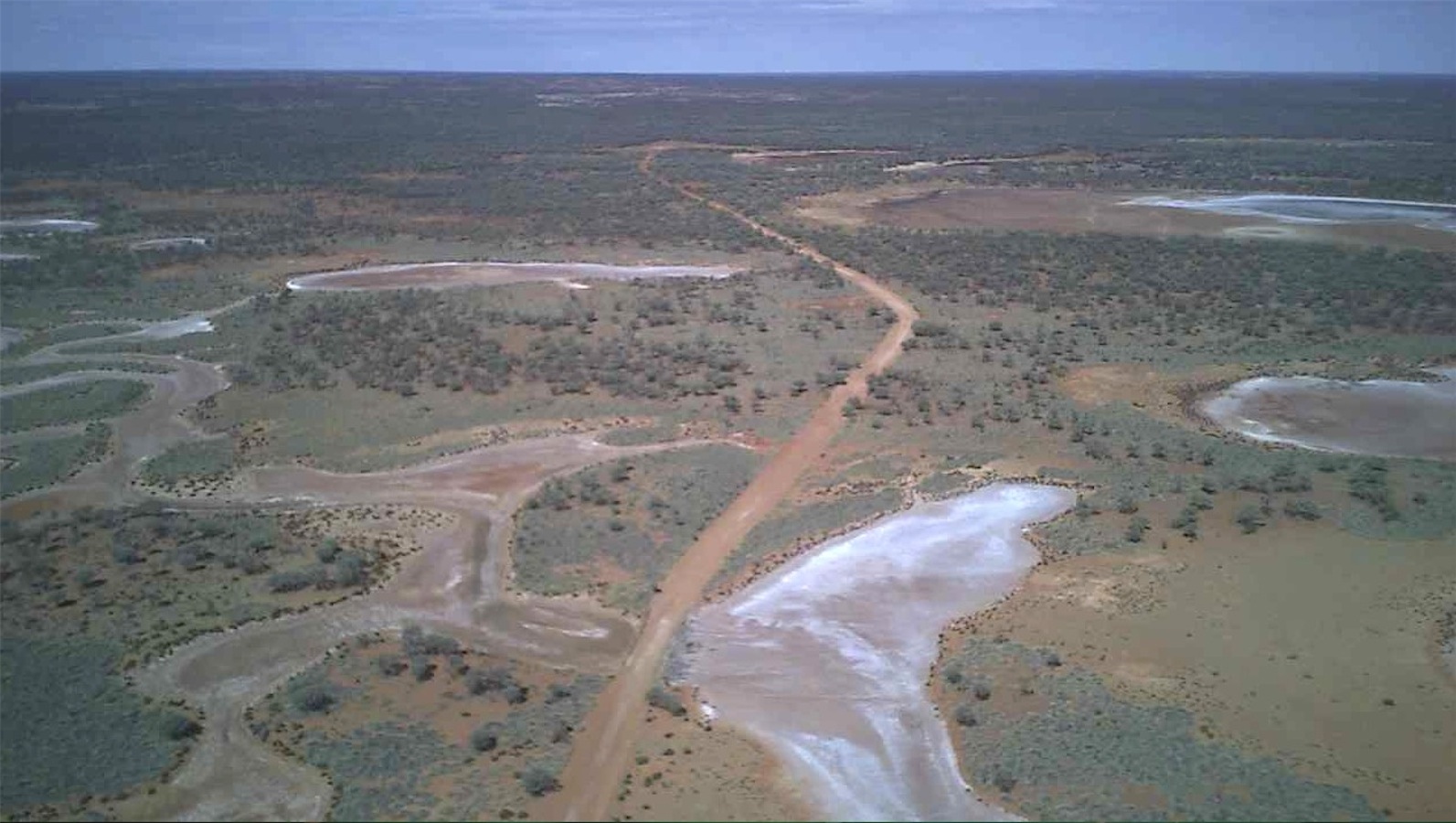
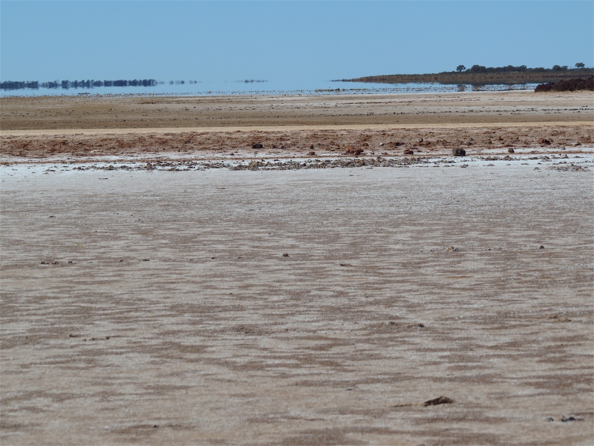 We left Yandal Station turning East for 20kms before heading South across Lake Darlot to Melrose Station. Lake Darlot
is quite an expansive Salt Lake system. Where we crossed over the Lake it was quite narrow and although damp, there was
no water in it. Looking both to the East and the West where the Lake widened, it looked like the Lake was filled with water
as the sun shimmered and danced off the glassy surface. We were fairly convinced this was only a mirage and then certain
of it when Don launched his Quadcopter and took in the aerial view.
We left Yandal Station turning East for 20kms before heading South across Lake Darlot to Melrose Station. Lake Darlot
is quite an expansive Salt Lake system. Where we crossed over the Lake it was quite narrow and although damp, there was
no water in it. Looking both to the East and the West where the Lake widened, it looked like the Lake was filled with water
as the sun shimmered and danced off the glassy surface. We were fairly convinced this was only a mirage and then certain
of it when Don launched his Quadcopter and took in the aerial view.


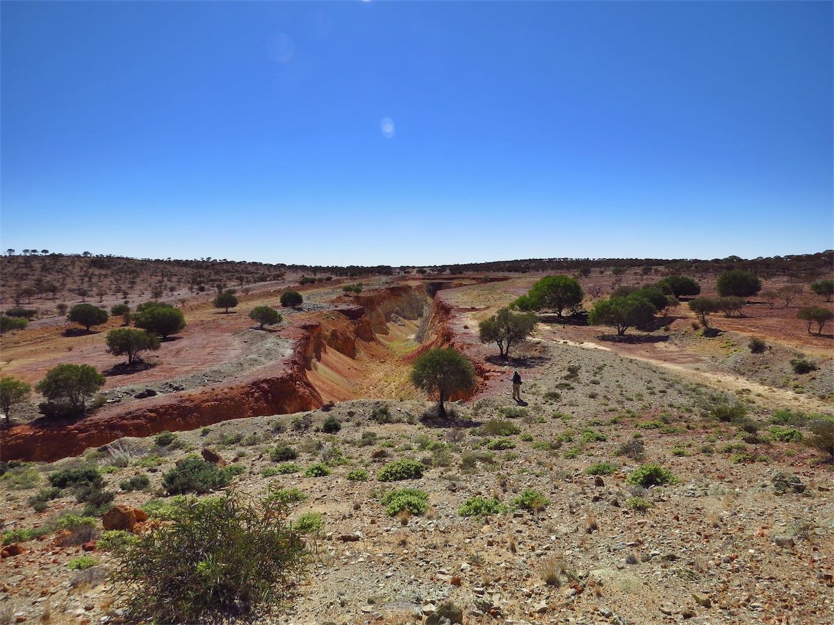
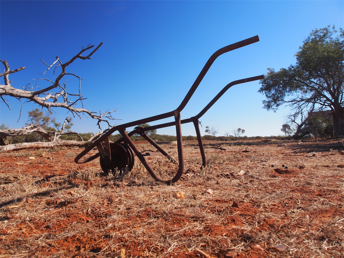
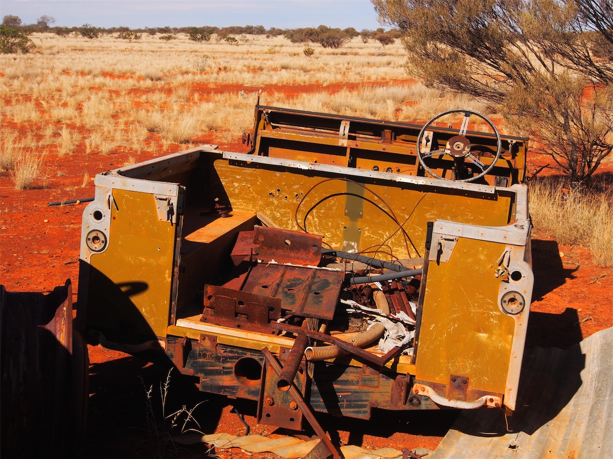
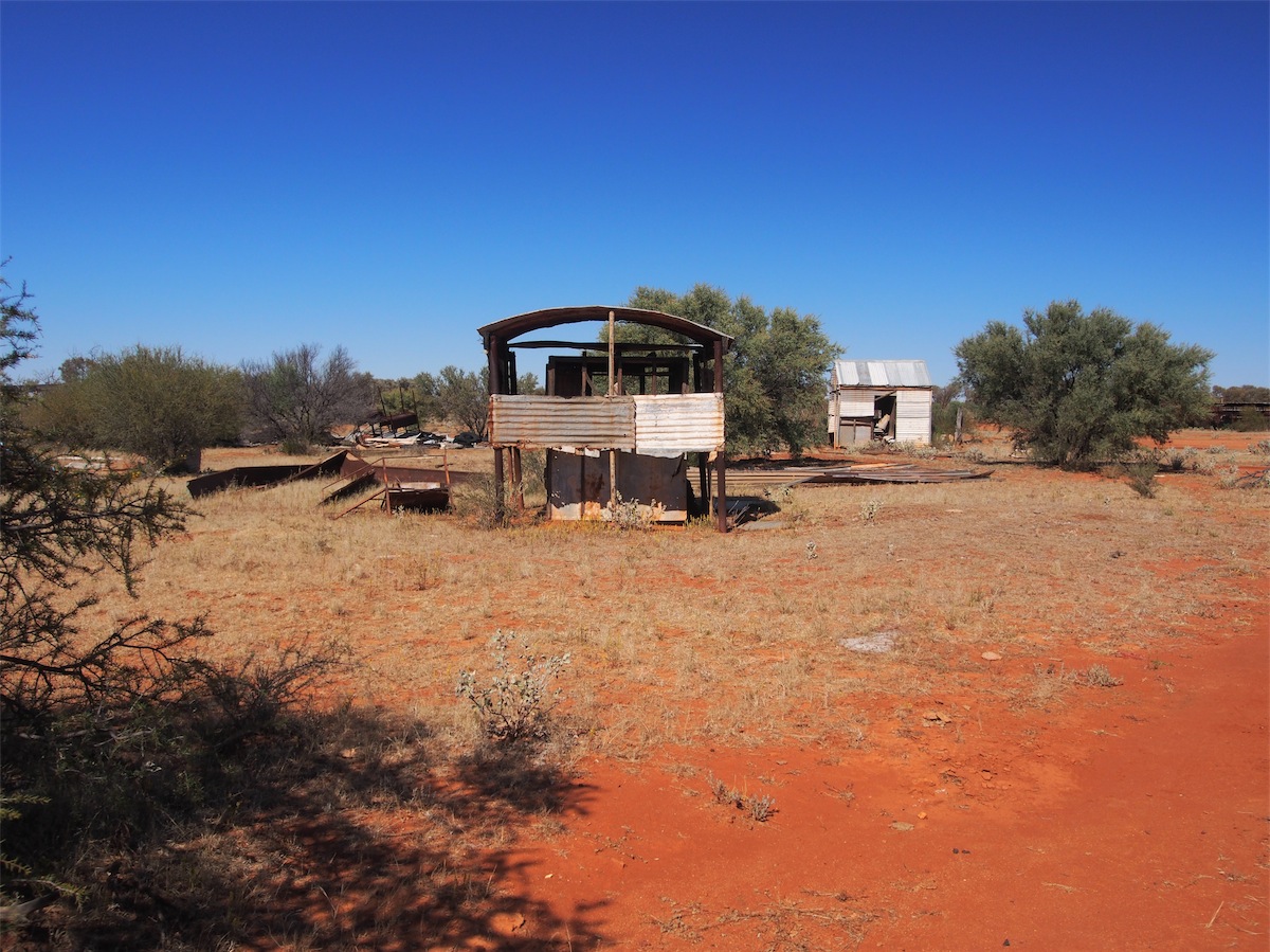
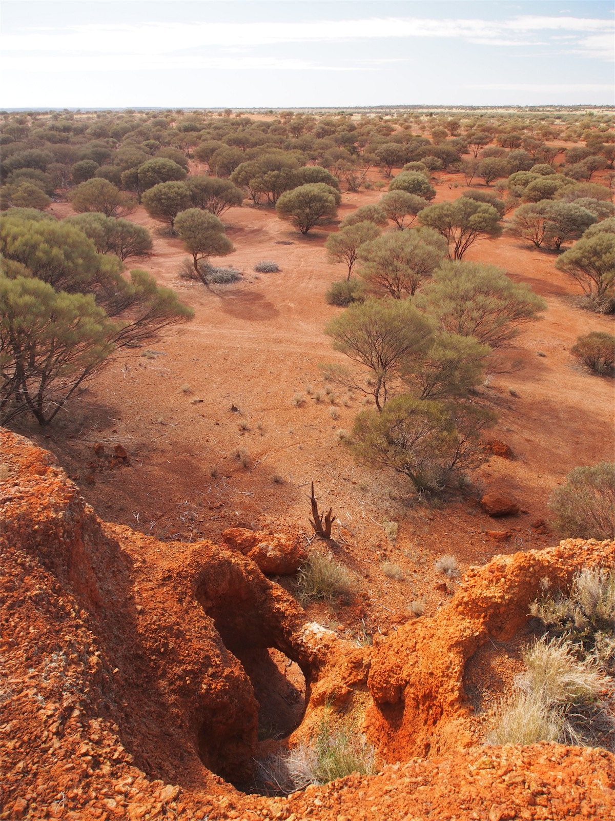
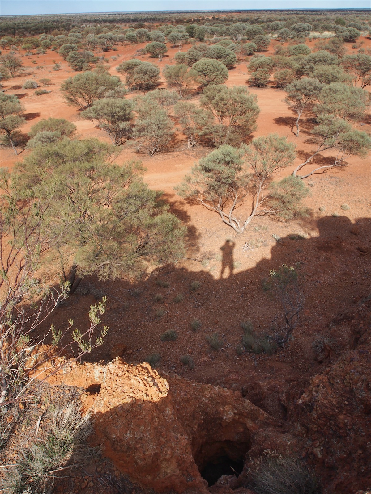
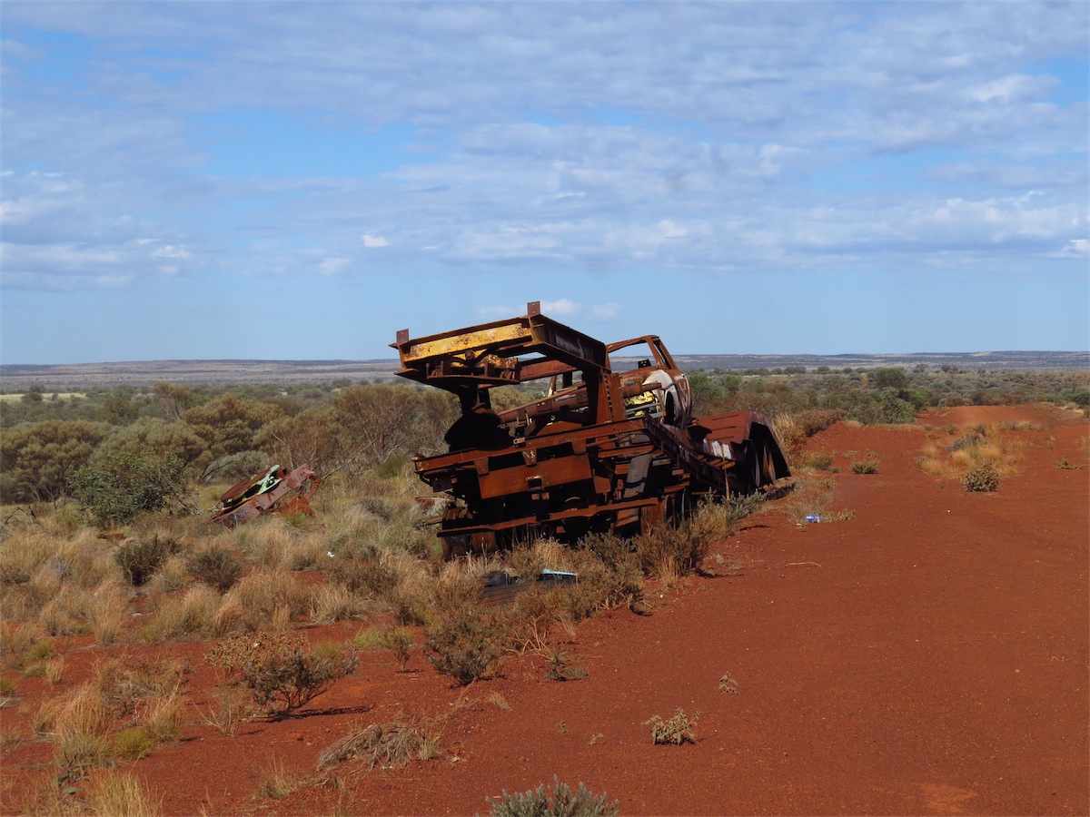
 We continued South passing Melrose Station then turned SE, stopping only a couple of Ks from Melrose to check out an
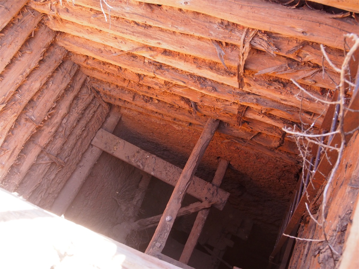
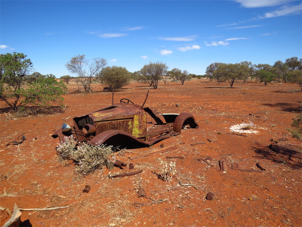
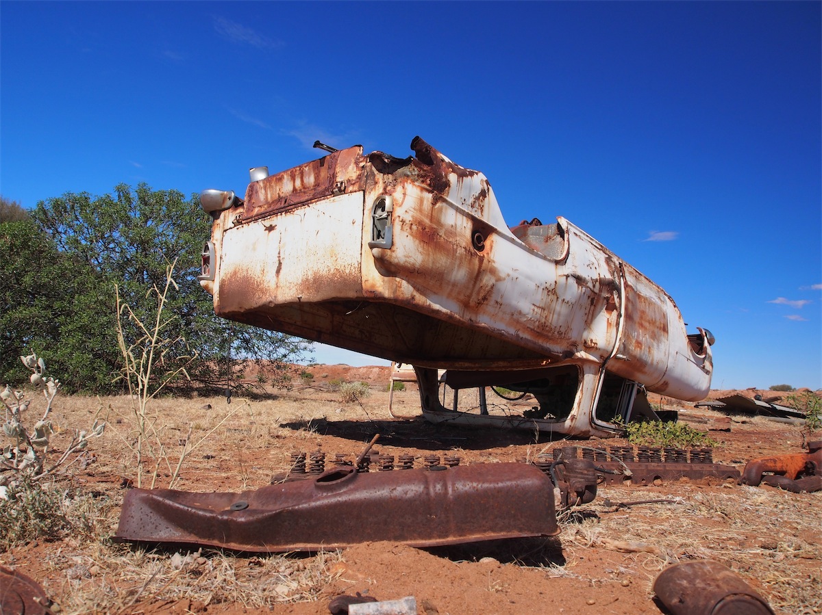
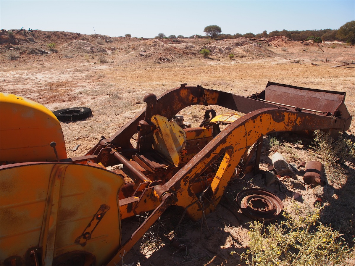
abandoned Mine Site. This area covered a couple of Hectares with a large area shallow dug to a few metres and one deep
Mine Shaft that we came across. The entire area was strewn with so much scrap iron that if you gathered it up and sold it
you could retire for life. The vehicle wrecks that lay about were vintage 50s/60s. The usual ‘bottle heaps’ and other general
rubbish lay about the site as well.
We continued South passing Melrose Station then turned SE, stopping only a couple of Ks from Melrose to check out an
abandoned Mine Site. This area covered a couple of Hectares with a large area shallow dug to a few metres and one deep
Mine Shaft that we came across. The entire area was strewn with so much scrap iron that if you gathered it up and sold it
you could retire for life. The vehicle wrecks that lay about were vintage 50s/60s. The usual ‘bottle heaps’ and other general
rubbish lay about the site as well.
 I just have an inbuilt aversion to ‘rubbish’ being tossed about with no
respect for the land but I’m here fossicking around and gaining some level of understanding of what took place here, so I guess
I can’t be a hypocrite.
I just have an inbuilt aversion to ‘rubbish’ being tossed about with no
respect for the land but I’m here fossicking around and gaining some level of understanding of what took place here, so I guess
I can’t be a hypocrite. We continued on passing another Outcamp and a number of interesting old Wells, some still in operation, others having seen better days. There were plenty of cattle enroute but one particular Bull caught our eye. He was so glossy and beautiful and stood proudly as he eyed us from a short distance. He looked quite not-plussed at our intrusion, almost seeming to pose for us as we took his photo.


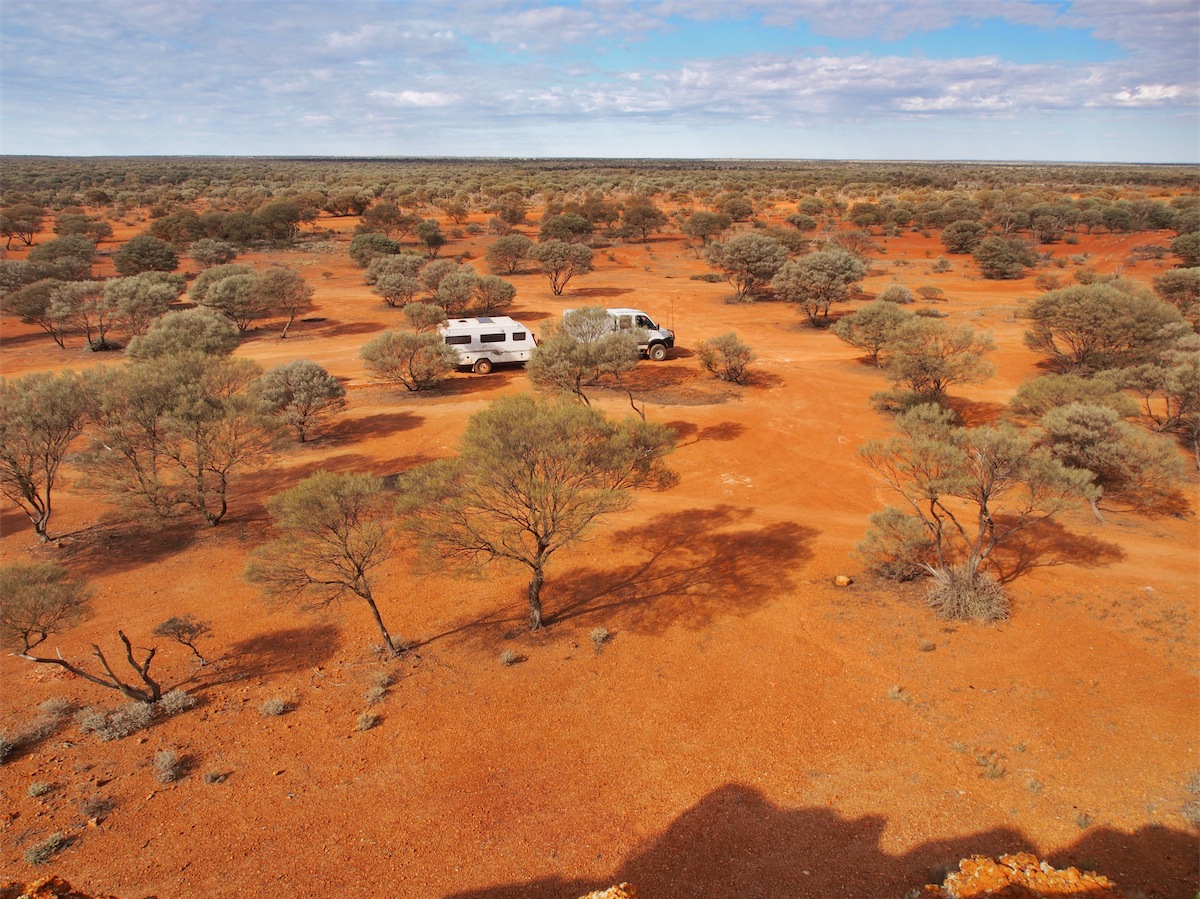
 approaching we decided to call it a day. We saw a narrow track leading into the bush not far from Jack Well and decided to investigate. Although
the track was narrow and over-grown, it soon opened up into a wide open area that had previously been mined that was just perfect
for our camp. The diggings were shallow with a couple of trenches maybe 20ft-30ft deep and 60ft wide with plenty of open space
around them. This was a lucky find as the area was quite densely treed with medium to small shrubs and plenty of undergrowth.
approaching we decided to call it a day. We saw a narrow track leading into the bush not far from Jack Well and decided to investigate. Although
the track was narrow and over-grown, it soon opened up into a wide open area that had previously been mined that was just perfect
for our camp. The diggings were shallow with a couple of trenches maybe 20ft-30ft deep and 60ft wide with plenty of open space
around them. This was a lucky find as the area was quite densely treed with medium to small shrubs and plenty of undergrowth.
Saturday 16th August, Laverton, WA
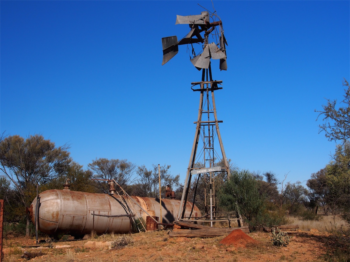
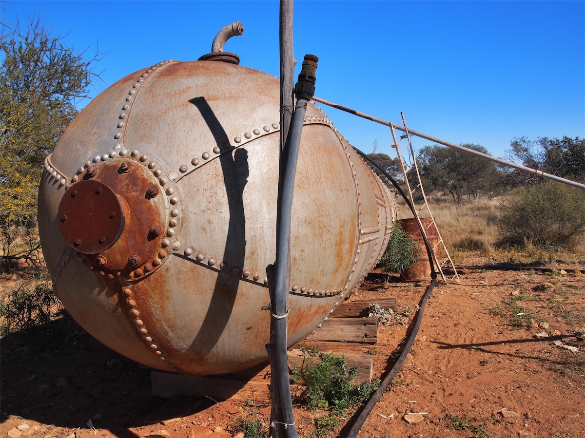
Another great camp site and another great morning. We packed up and continued East toward Erilstoun Station past a few more Wells, one of particular interest, no longer in operation but with a huge above ground tank shaped like a submarine. This was most likely designed originally as a pressure vessel from the steam-engine days but had been utilised as a water tank, which was quite innovative.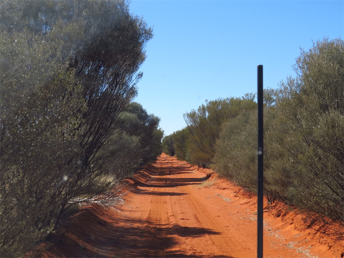
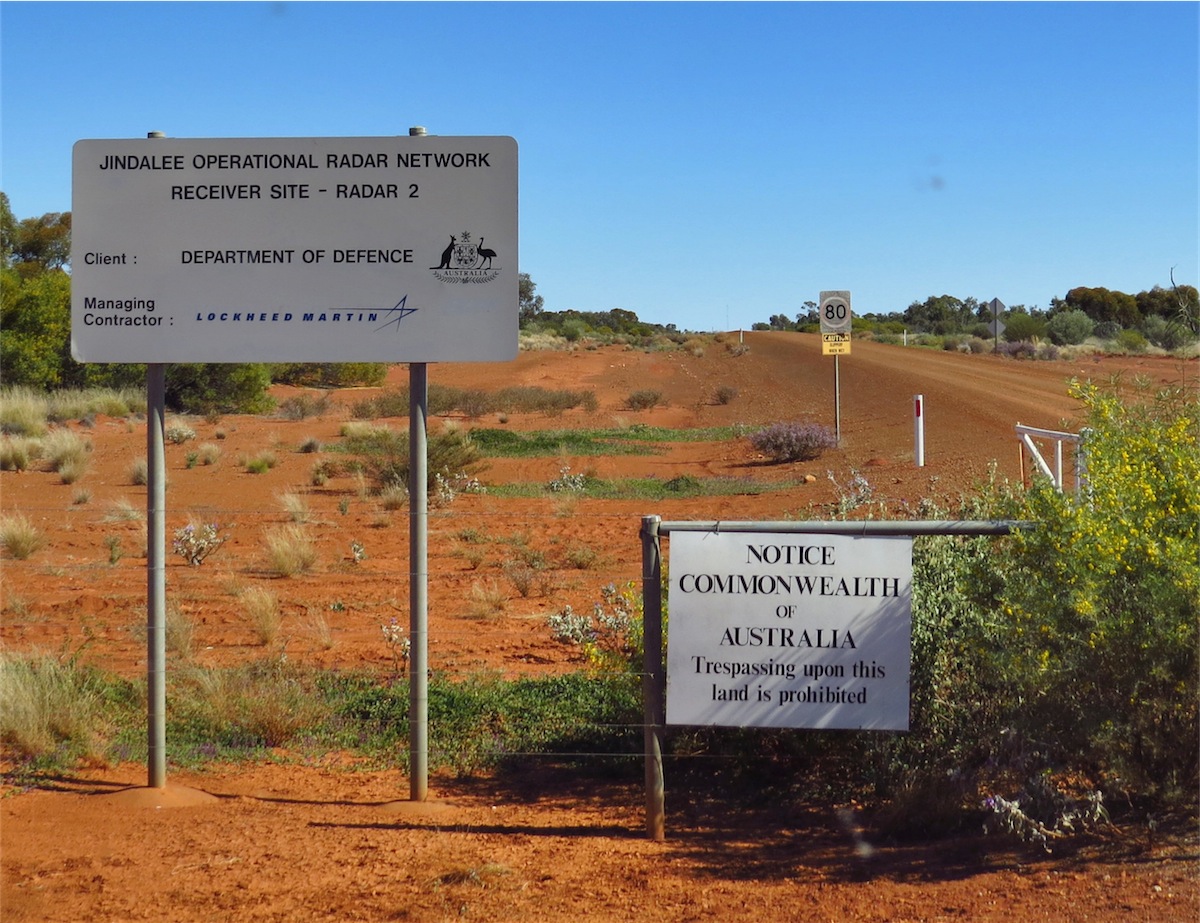 Our curiosity was soon satisfied as we passed by the entry gate leading into the Jindlee Operational Radar
Network (JORN). An Australian Government 24hr military surveillance complex of Australia’s northern approaches
which also serves civilian purposes such as weather forecasting and the prevention of illegal entry, smuggling
and unlicensed fishing.
Our curiosity was soon satisfied as we passed by the entry gate leading into the Jindlee Operational Radar
Network (JORN). An Australian Government 24hr military surveillance complex of Australia’s northern approaches
which also serves civilian purposes such as weather forecasting and the prevention of illegal entry, smuggling
and unlicensed fishing.
We turned South at this point and headed SE down to Laverton where we booked into the Caravan Park for the next couple of days.
Sunday 17th August, Laverton, WA
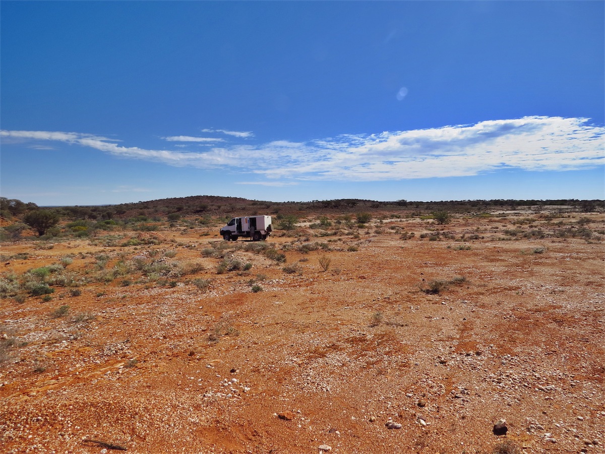
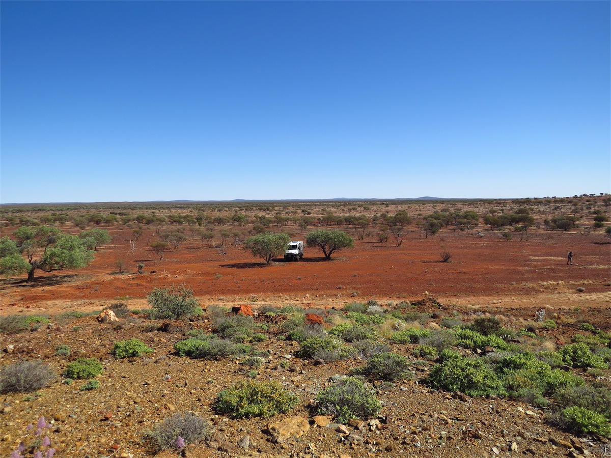
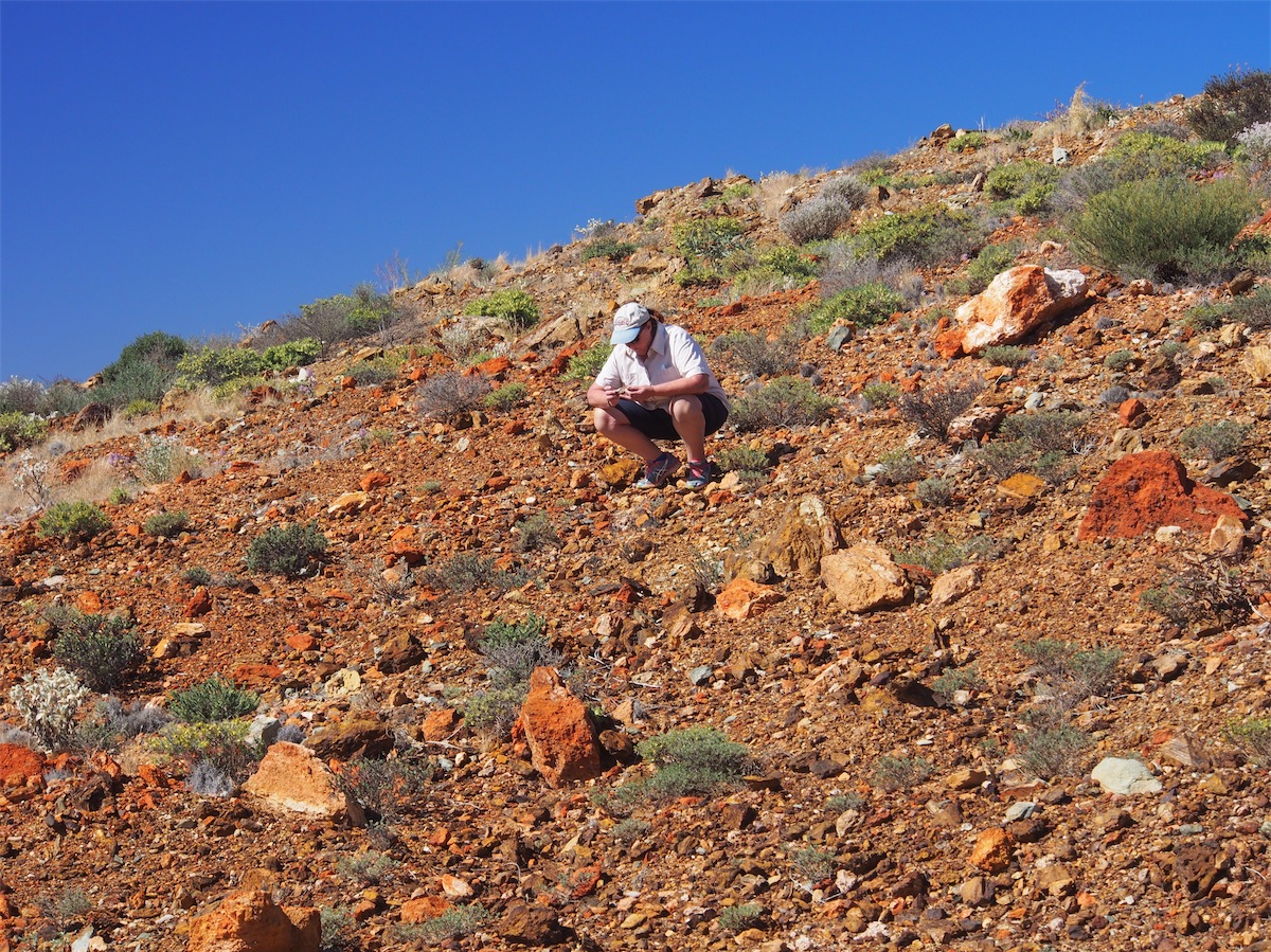
We spent today heading out into the Goldfields around the area, partly to do a bit of detecting and partly just to check out the surrounding countryside. Driving up through the hills was incredibly relaxing. It wasn’t long before Don found a spot he thought might be worth getting out his detector. Whilst Don ‘detected’ I opted out of ‘pick duty’ and went walk-about. It’s amazing just how far you end up walking when you are ambling along or sweeping the ground with the detector. The funny thing was that both Don and I headed off in opposite directions and ended up crossing paths about a kilometre away.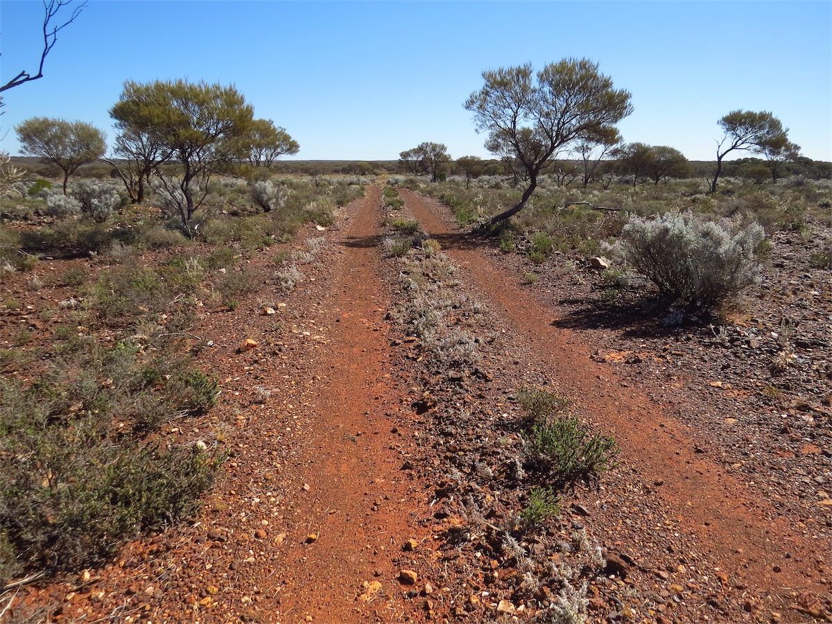


track to gold .... Not! another bloody bullet Lunch Time spider under rock
With no luck on the detecting side of things we decided to hit the road again and explore the surrounding hills. Each time we took a track off-road, we ended up coming out onto an unmarked road. These roads invariably ended up being blocked off and upon further investigation we found they were the residual of a now defunct nickel mine. These roads were wide and smooth but now served no purpose. Such is the way of these mining areas in the West. Roads are here today and gone tomorrow.
Monday 18th August, Laverton, WA
Nothing really to Blog about today. A day of chores and washing before we head off tomorrow.
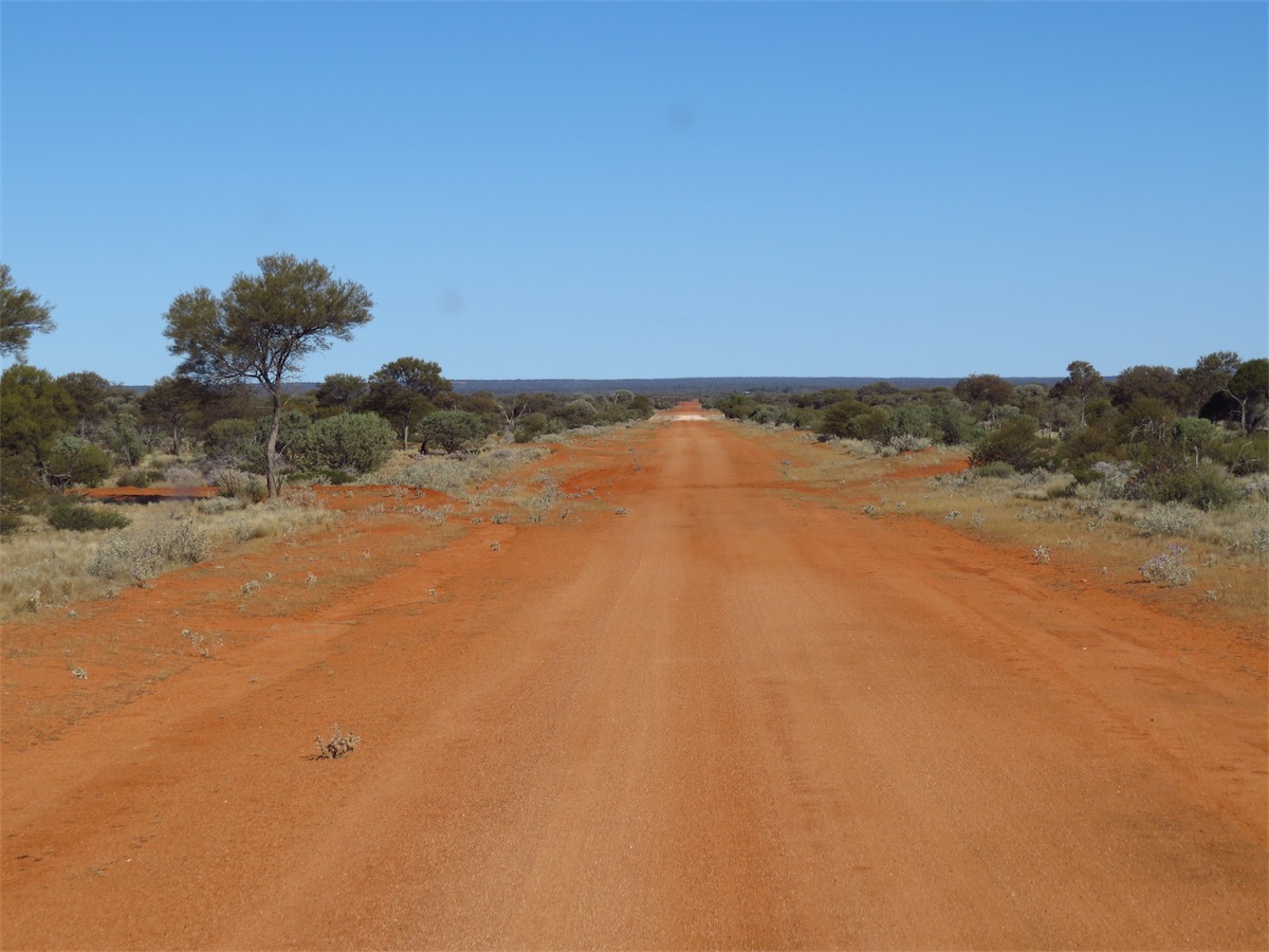
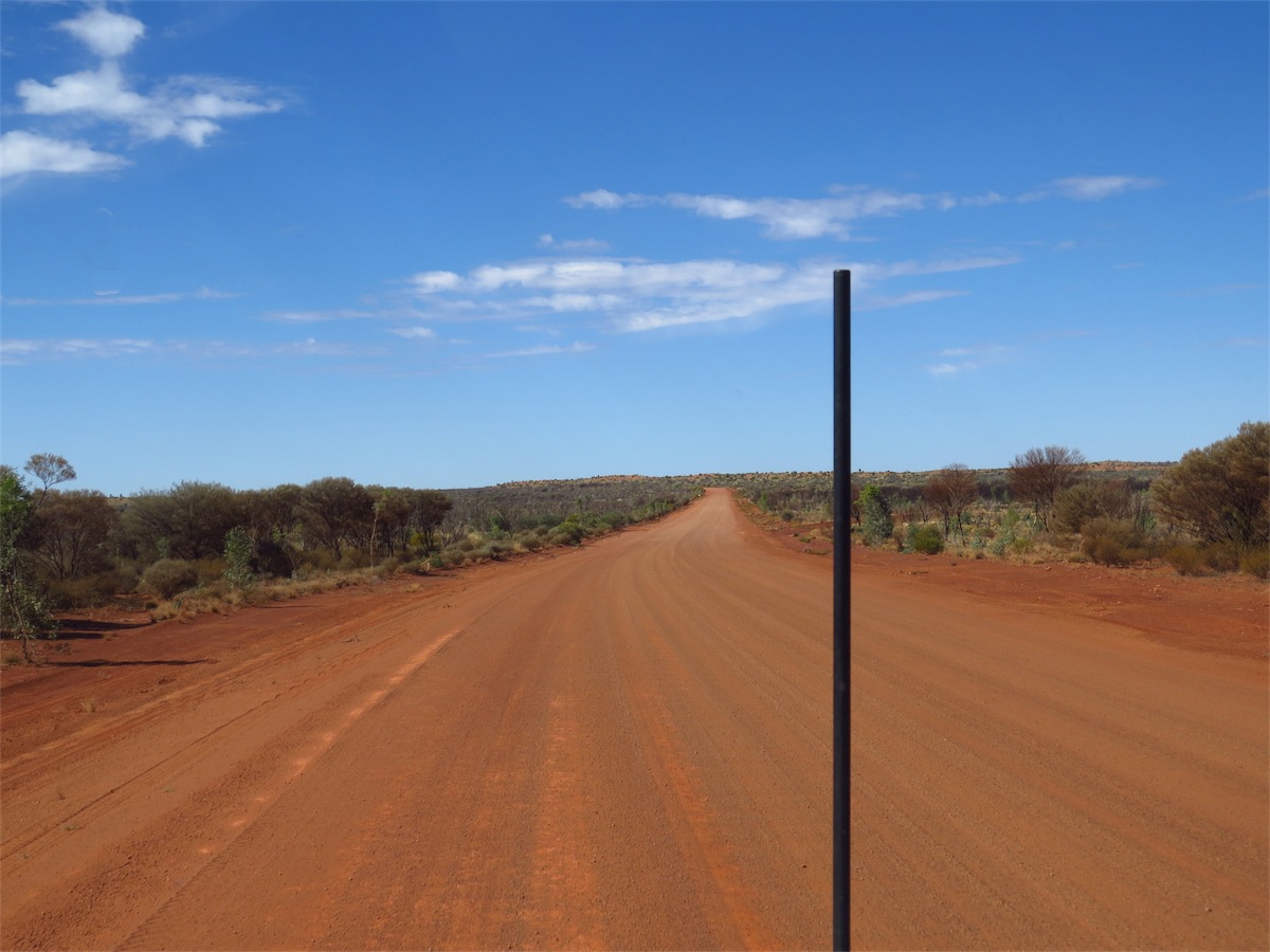
Tuesday 19th August, Bush Camp (90k East of Tjukayirla) WA
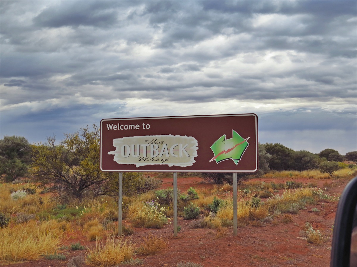 We packed up early this morning, wanting to get an early start as we had a long drive ahead of us today and
not having crossed over the Great Central Road (aka The Outback Way) before, we were unsure of the availability of camp sites. So
we were on our way and heading East by 0730.
We packed up early this morning, wanting to get an early start as we had a long drive ahead of us today and
not having crossed over the Great Central Road (aka The Outback Way) before, we were unsure of the availability of camp sites. So
we were on our way and heading East by 0730.
 There had been light showers during the night and it was still raining slightly when we left which unfortunately,
dulled the light and inhibited the taking of good photos. We were only about 30ks from Laverton when we made
our first stop of interest at the Deba Gnamma Hole. A Gnamma hole was one of the main sources of water for the
Aboriginal people. These natural cavities are found in hard rock, particularly granite outcrops. These ‘holes’ act as
natural water tanks, replenished from underground water courses and rainwater run-off. The small surface area of
these holes minimises evaporation.
There had been light showers during the night and it was still raining slightly when we left which unfortunately,
dulled the light and inhibited the taking of good photos. We were only about 30ks from Laverton when we made
our first stop of interest at the Deba Gnamma Hole. A Gnamma hole was one of the main sources of water for the
Aboriginal people. These natural cavities are found in hard rock, particularly granite outcrops. These ‘holes’ act as
natural water tanks, replenished from underground water courses and rainwater run-off. The small surface area of
these holes minimises evaporation.
The Aboriginal way of life was to be forever changed once the influx of people flooded the Goldfield areas, draining, destroying and polluting these precious water sources with the animals they brought with them. Some were taken over and lined to create more permanent water supplies for the newcomers. Western goods and the way of life had reached inland Australia.
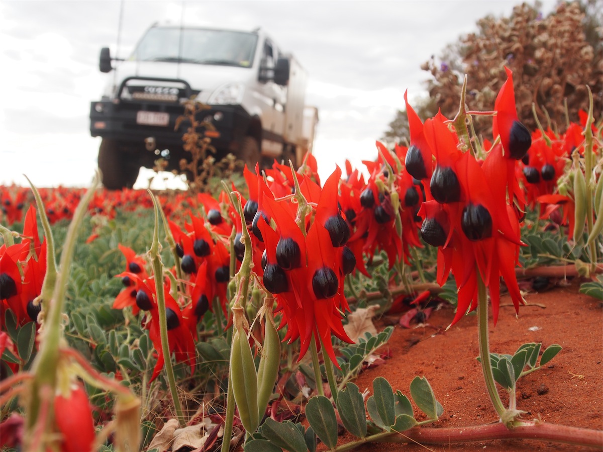
 We passed through the Cosmo Newberry Community and up through Lake Throssell. The rain clouds were left behind
and we headed into blue skies and sunshine. A beautiful array of Sturt Desert Peas just cried out to be photographed;
they are such a unique and colourful flower. As we neared the Tjukayirla Roadhouse, a Dingo crossed in front of us.
This Dingo had a patchy, brindled colouring indicative of hybridisation with domestic dogs.
We passed through the Cosmo Newberry Community and up through Lake Throssell. The rain clouds were left behind
and we headed into blue skies and sunshine. A beautiful array of Sturt Desert Peas just cried out to be photographed;
they are such a unique and colourful flower. As we neared the Tjukayirla Roadhouse, a Dingo crossed in front of us.
This Dingo had a patchy, brindled colouring indicative of hybridisation with domestic dogs.
Wild dogs have been deemed a major pest species impacting on grazing industries across mainland Australia. In 2012 an estimated 42,200 stock were killed in WA by wild dogs, mainly sheep, with a value of $6.3 million. Effective in January 2014 a $100 per dog bounty was introduced by the WA Government to try to gain some control over the numbers in grazing and pastoral areas where severe losses have occurred.

 Dingos are beautiful looking animals but unfortunately they are not disseminated in the baiting and bounty control of
Wild Dogs.
Dingos are beautiful looking animals but unfortunately they are not disseminated in the baiting and bounty control of
Wild Dogs.
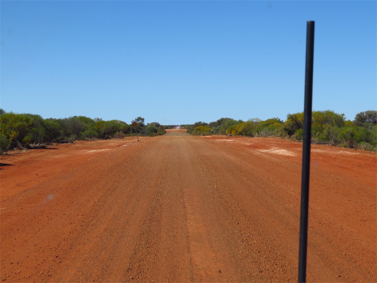
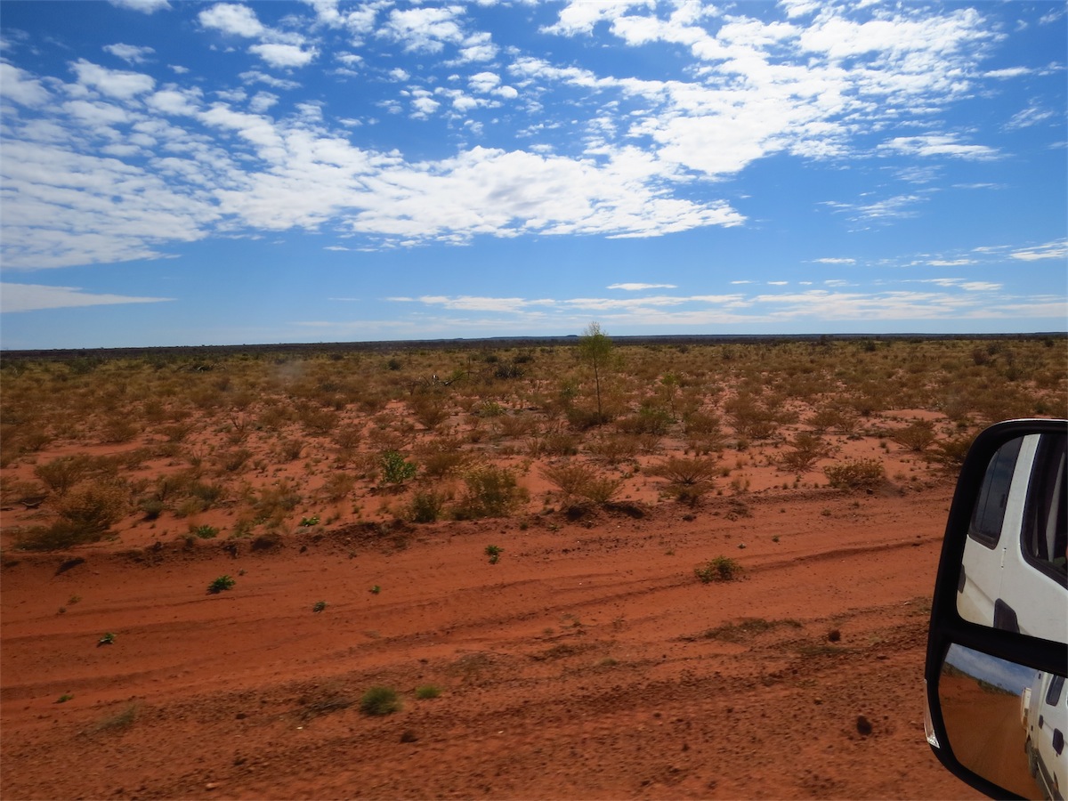
We reached the Tjukayirla Roadhouse just in time for lunch, then fuelled up and continued on. The Great Central Road is in excellent condition. There were a few patches of corrugations but the truck easily smoothed them out. We found a nice camp site 90k East of Tjuykayirla and set up for another night under the stars.


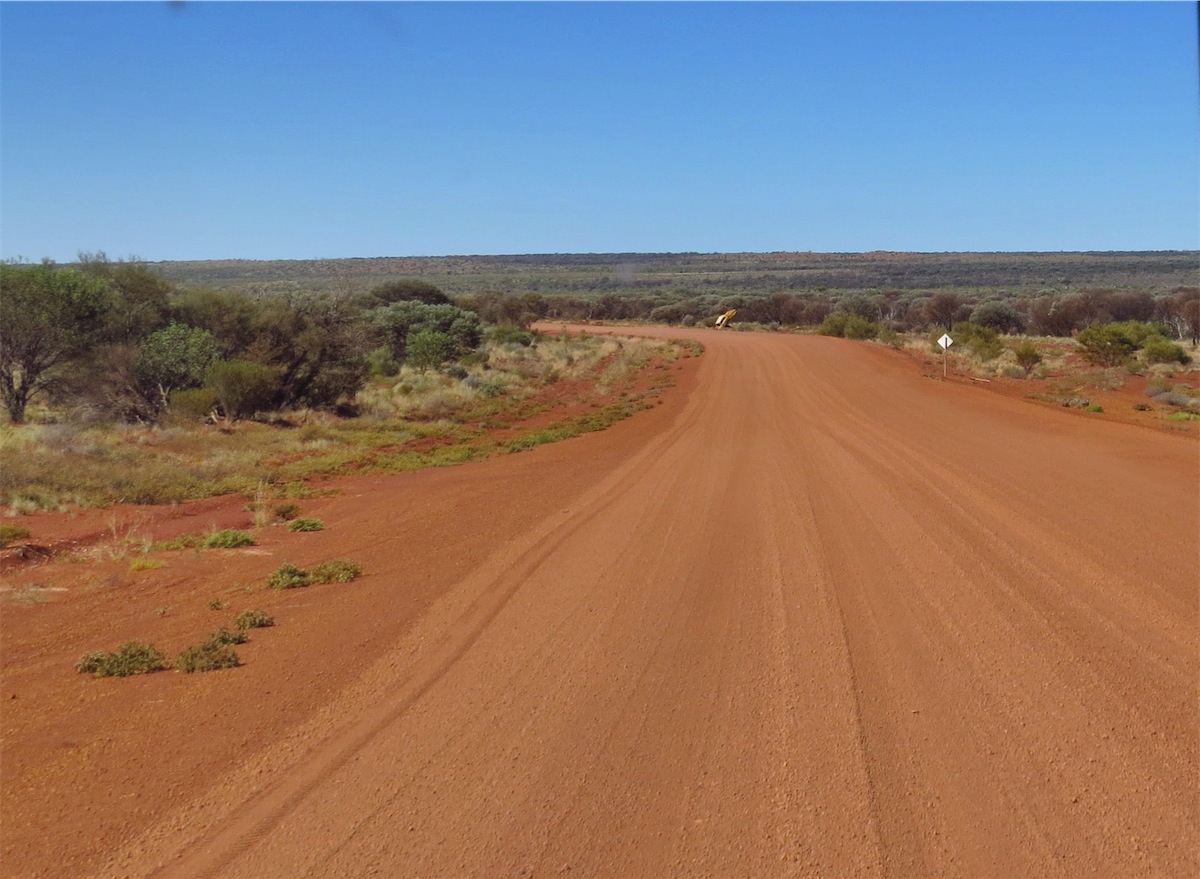

Wednesday 20th August, Warakurna Roadhouse, WA
Another early start today. About 30ks on from where we camped we stopped at the Desert Breakaway and Gnamma Hole, This is a great little spot and would be an excellent place to camp. There are so many places along this route that we want to come back and explore. This time across was mainly to sus it out. As we only have a three day Permit it doesn’t leave too much time to explore all these areas. We will be more aware next time.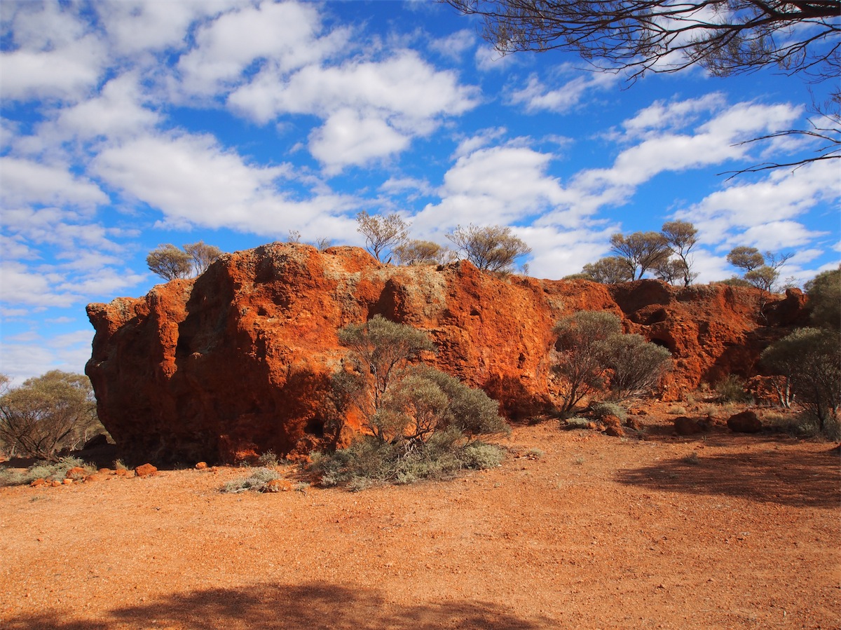
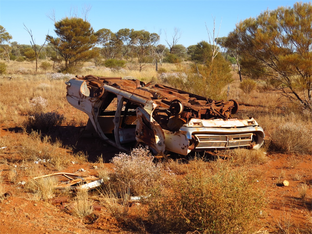
 I mentioned in yesterday’s Blog how excellent the road was but the amount of car wrecks that litter the sides of the road would
bely this statement. We are keeping a rough tally out of interest. We came across some car wrecks that were being transported
on the back of a road-train, which in itself had also become a wreck, still with a car loaded atop and a couple strewn on the ground.
I mentioned in yesterday’s Blog how excellent the road was but the amount of car wrecks that litter the sides of the road would
bely this statement. We are keeping a rough tally out of interest. We came across some car wrecks that were being transported
on the back of a road-train, which in itself had also become a wreck, still with a car loaded atop and a couple strewn on the ground.We reached Warburton Roadhouse and stopped there to fuel up and grab a coffee. No photos are permitted to be taken in this area. It is home to the Warburton Ranges Mirlirrtjarra Community in the Ngaanyatjarra Lands, situated between the Gibson Desert to the North and the Great Victoria Desert to the South. The Aboriginal people in Warburton still hunt and gather bush tucker in traditional ways and work within the Community painting, making artefacts, art glass and other craftwork.
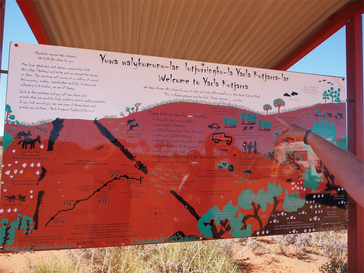
 Leaving Warburton we continued East through the Warbuton Ranges, stopping for lunch at a Resting Place erected and painted by the local
Aboriginal people. Disappointing to see some ‘smart alec’ had defaced the hand-painted signage board that had been erected to explain the area and its significance to the local Ngaanyatjarra people and welcoming visitors to
Leaving Warburton we continued East through the Warbuton Ranges, stopping for lunch at a Resting Place erected and painted by the local
Aboriginal people. Disappointing to see some ‘smart alec’ had defaced the hand-painted signage board that had been erected to explain the area and its significance to the local Ngaanyatjarra people and welcoming visitors to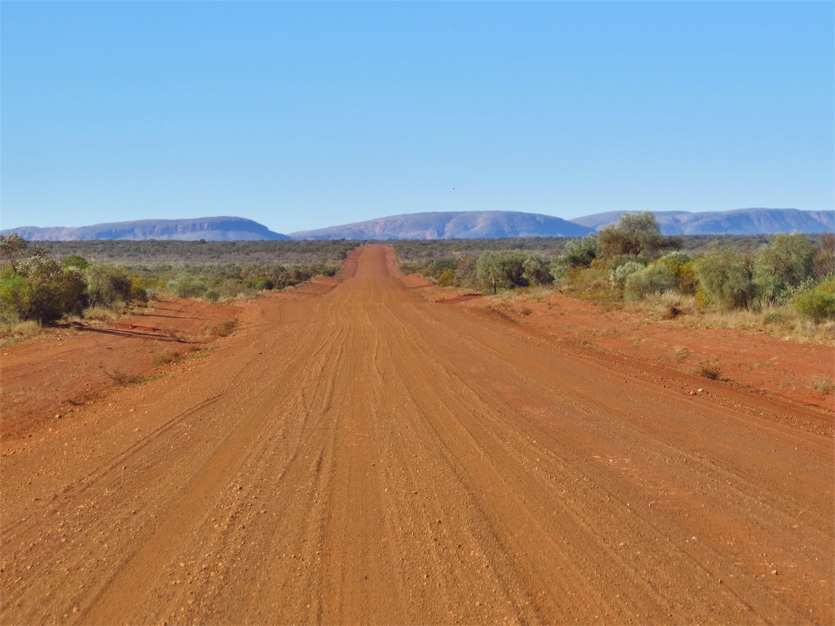 enjoy it. It’s times like these we can only cringe with distaste.
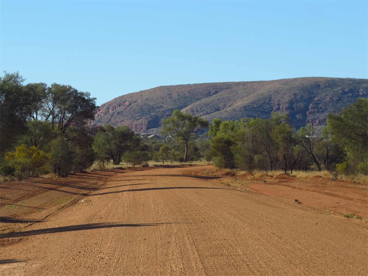
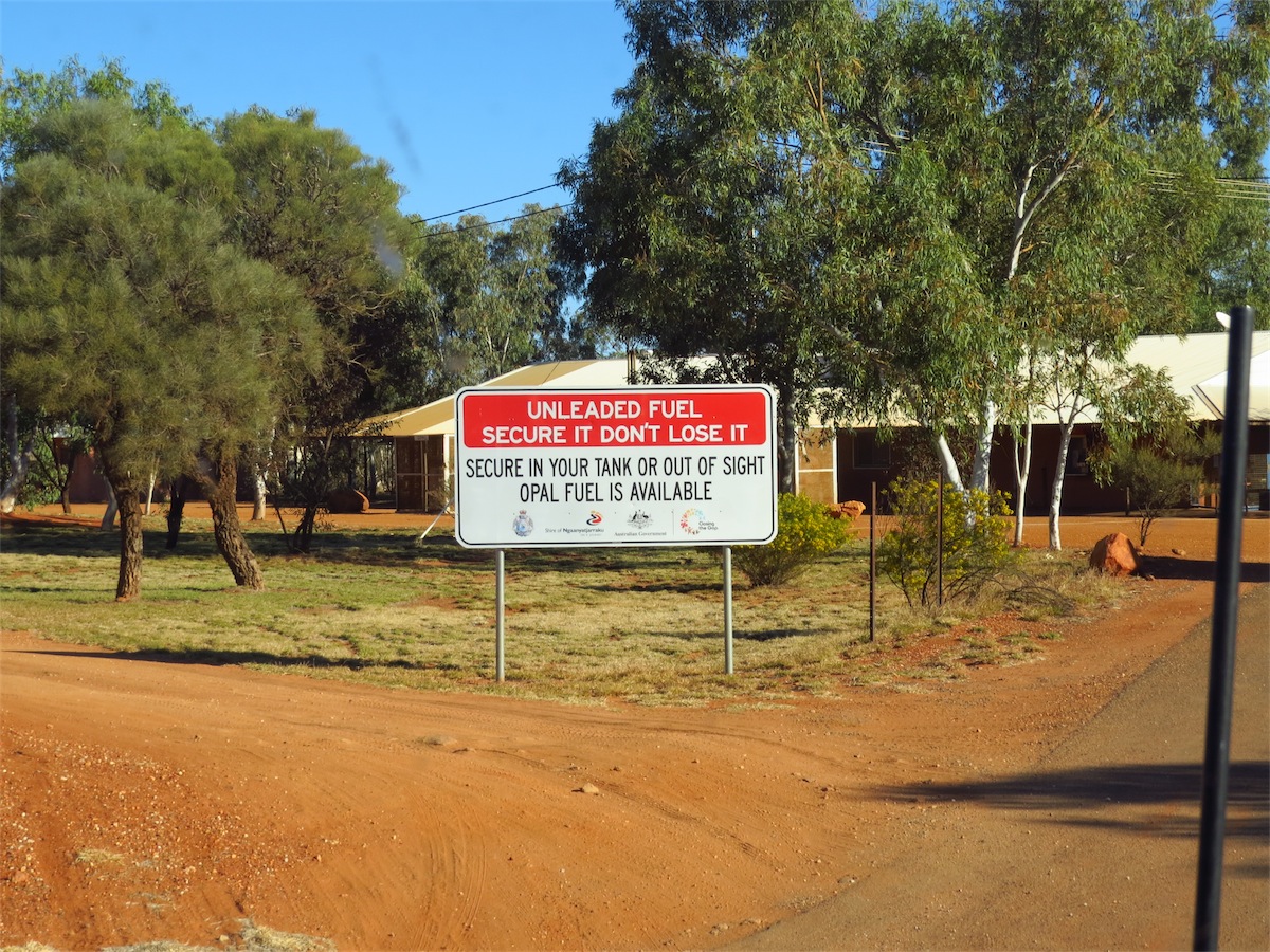
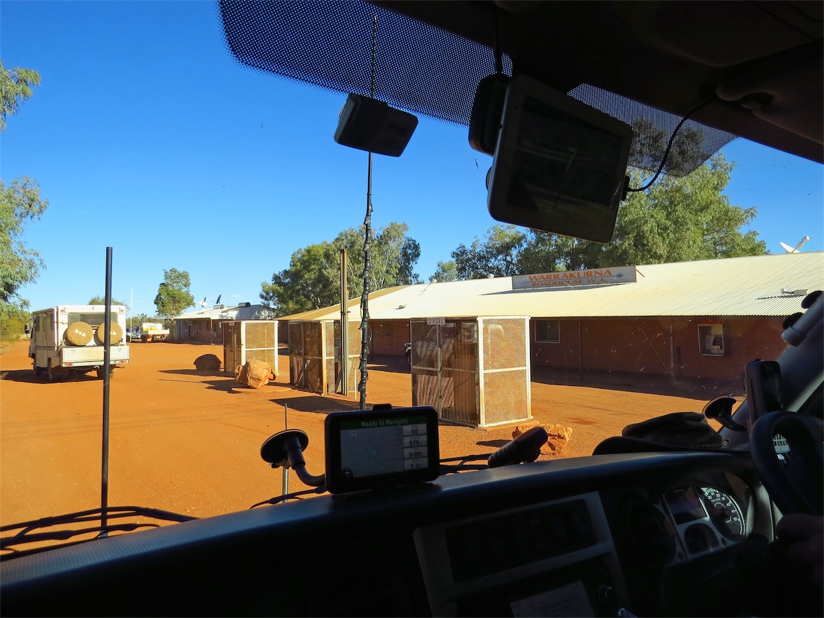
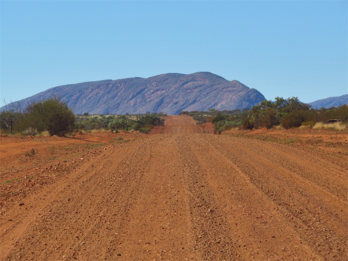
Back on the road again we could see the Rawlinson Range or the Cavanagh Range (it is unclear in any map) in the distance. This Range is extremely picturesque and provides a post-card effect of all the colours and shapes that are indicative of the Australian Outback. We pulled into the Warakurna Roadhouse just before 1530 only to discover we are now on NT time and immediately jumped ahead an hour and a half. Calling it a day, we booked into the Caravan Park behind the Roadhouse and set up camp.
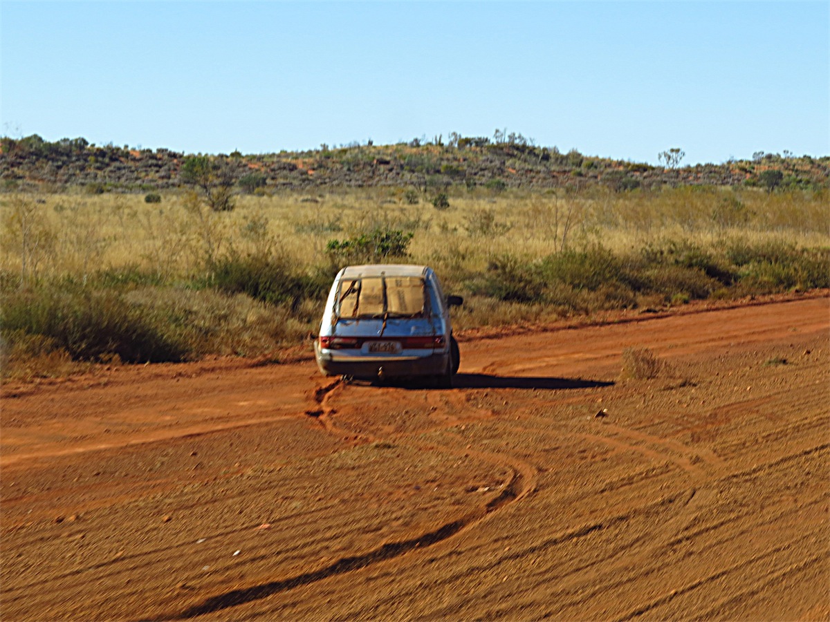
773 kms / 260 visible car wrecks = 1 wreck every 2.97 kms.
Thursday 21st August, Warakurna Roadhouse, WA
A catching up day.Not having any internet for a number of days we have quite a few days of Blog to catch up on, so we propped here to do just that. Just selecting the few photos for the Blog is a huge task out of the 400-500 photos taken per day.
Don has this difficult task which he does really well.
The only disappointment is not being able to include Don’s arial movies that he takes from the Quadcopter as we do not have enough Bandwidth to upload these. But hopefully the ‘stills’ Don selects from the movies will give some indication.
Back on the move tomorrow and heading for Docker River.
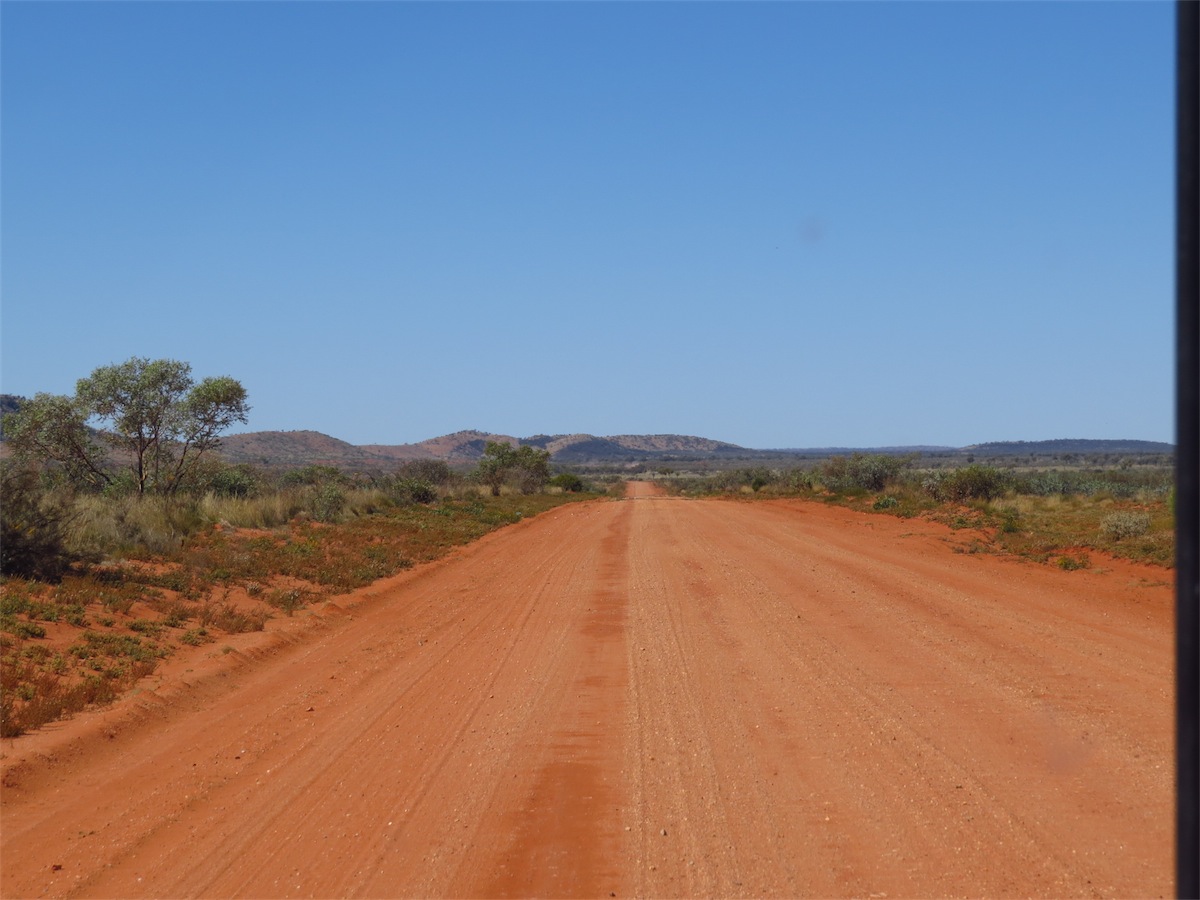
Friday 22nd August, Bush Camp (20K E Armstrong Creek, Great Central Road) NT
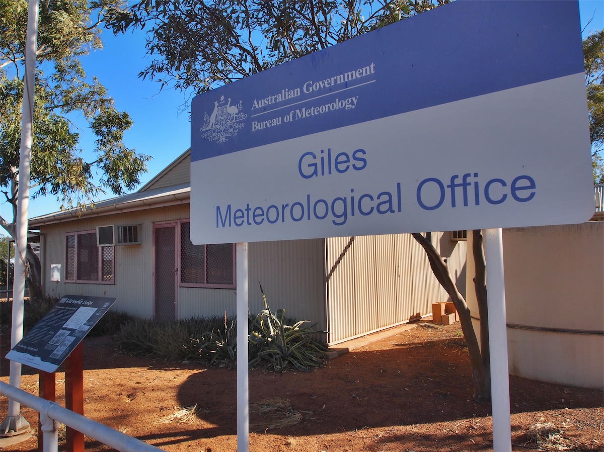
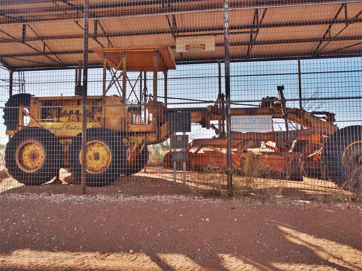
We fuelled up before leaving Warakurna then called into the Giles Weather Station which is about 1 km from the Roadhouse. The Weather Station was not open for tours which was disappointing but there were some interesting memorabilia displayed in the yard.One of the original Graders used to push a track through the bush to open up the Gunbarrel Highway was on display along with some of Len Beadell’s original Survey Plaques showing the many tracks that he surveyed to open up access across Australia. Len Beadell also chose the site for the Giles Weather Station.


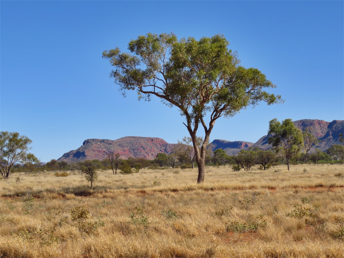
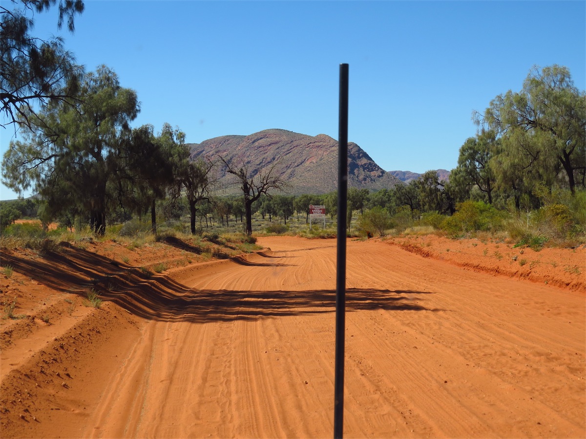
I wasn’t sure of the name of the Range yesterday but I am today. The Petermann Ranges are spectacular. Especially picturesque is the Schwerin Mural Crescent, the colours and shapes are an amazing backdrop to the red earth and soft greens of the bush.
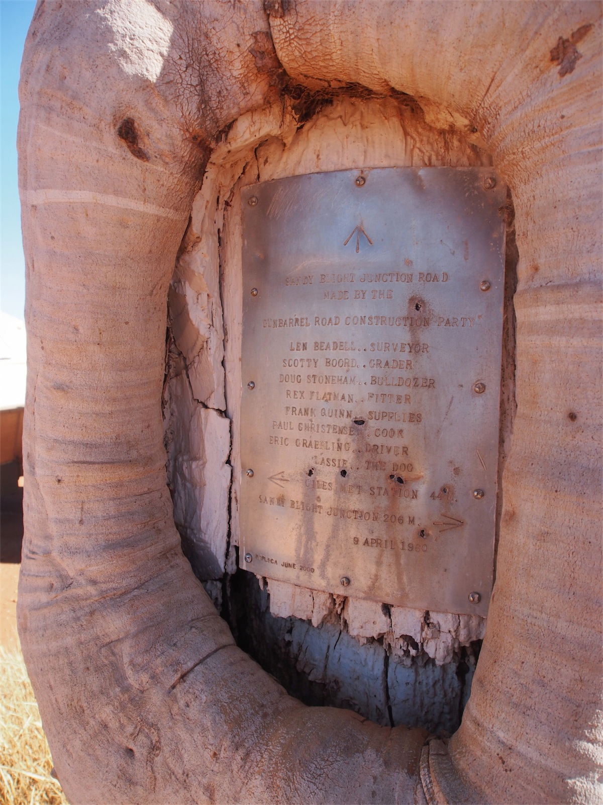 Len Beadell’s Surveying Plaques are located in various places along the Outback roads but a lot of the original
ones have been stolen. Replica Plaques have been attached in quite a few places but it is still pot-luck if these
are in place. Today we actually came across one of the replica’s that is lucky enough to still be attached to
a tree.
Len Beadell’s Surveying Plaques are located in various places along the Outback roads but a lot of the original
ones have been stolen. Replica Plaques have been attached in quite a few places but it is still pot-luck if these
are in place. Today we actually came across one of the replica’s that is lucky enough to still be attached to
a tree.We reached the Northern Territory Border where I ceased our tally of the car wrecks. From Warakurna to the Border we counted another 32 for 101kms which is on par with yesterday’s estimate…….1 every 2.97kms. Along with the cars that were wrecked there was also four caravans that had come to grief.


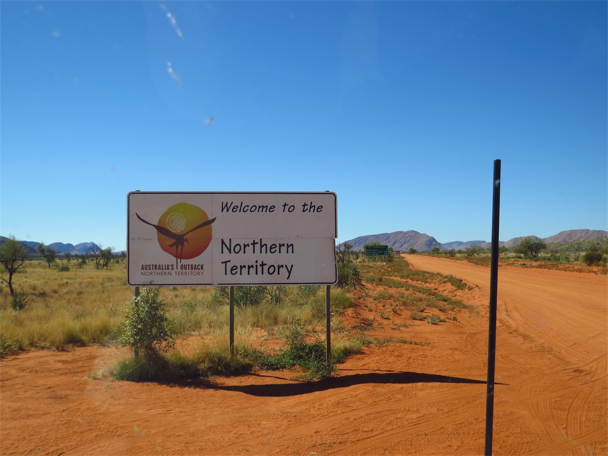 Once we reached the NT Border, the road immediately deteriorated. The corrugations were extremely bad and
would have played havoc with a smaller vehicle.
Once we reached the NT Border, the road immediately deteriorated. The corrugations were extremely bad and
would have played havoc with a smaller vehicle.
We called into Docker River Community thinking we may get a coffee or something to drink but only stayed a few minutes before heading back out onto the track and continuing Eastward.
The next stop was one that had great meaning to both of us…..Lasserter’s Cave. I will relate a very brief snippet of why.
When Don and I went on our first date we were sitting on the floor in front of the fire at his place chatting about this and that when I happened to mention excitedly that I had recently purchased a replica of Lasserter’s Diary. Don jumped up and hurried from the lounge room saying he would be back in a minute. Next minute he returned with a large smile on his face and a Lasserter’s Diary replica in his hand, one that he had recently purchased.
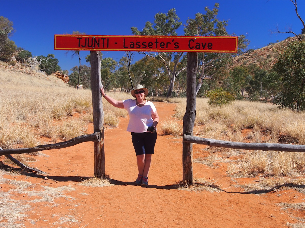
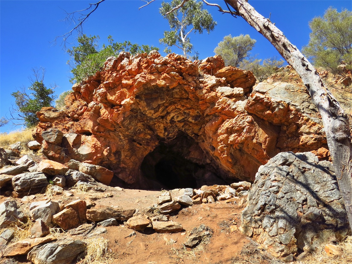
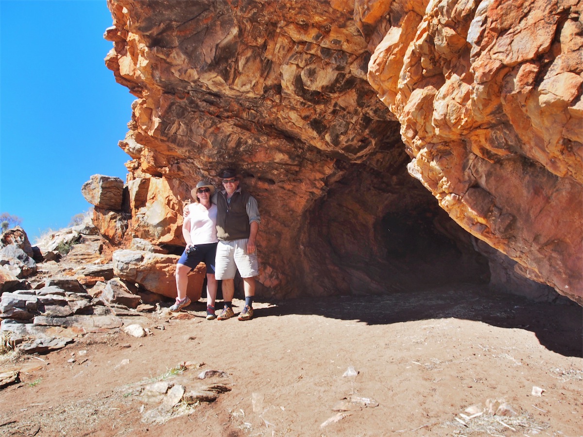
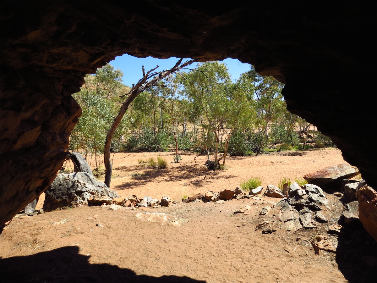
 And now here we stood, together at the mouth of Lasserter’s
Cave, over twenty-four years later, still connected!!
And now here we stood, together at the mouth of Lasserter’s
Cave, over twenty-four years later, still connected!!We took the opportunity of the stop to have lunch before taking our leave of Lasserter and continuing on. We were probably only about an hour or so away from the Olga’s but decided to look out for a camp site, far less crowded out here in the bush.
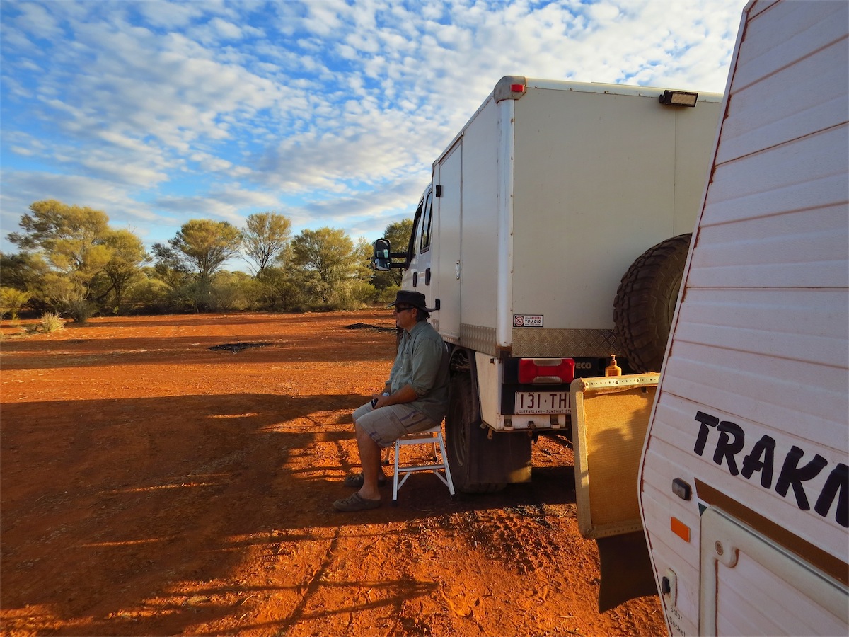
About 20k past Armstrong Creek we came across a really good camp spot, another excellent site for our camp. It didn’t take us long to set up, leaving enough time for a few chores and a quick spin of the quadcopter.
Saturday 23rd August, Yalara, NT
We headed off this morning at 0830 knowing that we would not be enjoying the solitude of the bush for awhile but looking forward to the day ahead. The last time I had visited Ayers Rock and the Olgas it had been with my Father so I was looking forward to sharing the experience with Don.
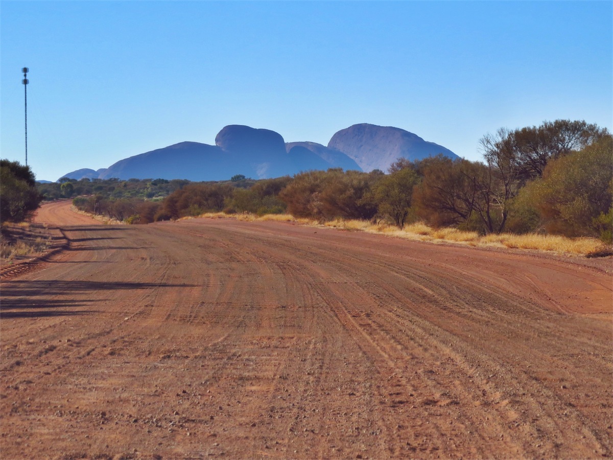
 Last night we had camped about an hour West from the entry into the Ulura-Kata Tjuta National Park so
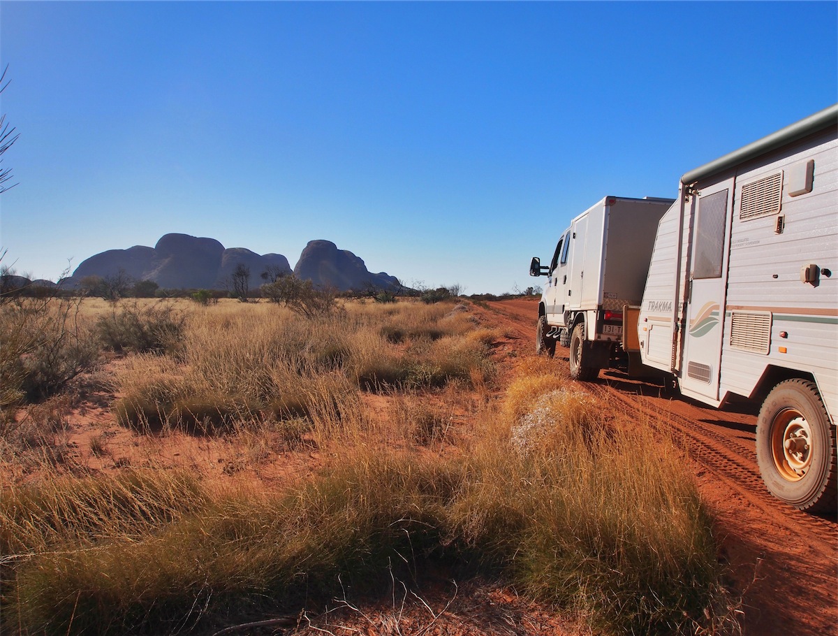
it wasn’t long before we could see the vast purple/blue shape of the Olgas (Kata Tjuta) looming before us.
What a truly amazing sight.
Last night we had camped about an hour West from the entry into the Ulura-Kata Tjuta National Park so
it wasn’t long before we could see the vast purple/blue shape of the Olgas (Kata Tjuta) looming before us.
What a truly amazing sight.
For the next hour our focus was entirely on watching the different aspects of the Olgas as we approached. When we arrived at the parking area below the huge rocks is was quite an awesome sight. Climbing of the Olgas is not allowed. The viewing area is on the West side of the huge rock outcrop, the opposite side to where I had climbed them with my Father many years ago. I was a little disappointed that I was unable to share this experience with Don but we agreed that it was a special memory I can keep of my Father and me.
 We left the parking area and drove a little further on where Don launched his Quad for a quick look at the
surrounding landscape from the air. When you view this footage you get a total appreciation of just how
enormous the Olgas are. The largest Dome is 546 metres high.
We left the parking area and drove a little further on where Don launched his Quad for a quick look at the
surrounding landscape from the air. When you view this footage you get a total appreciation of just how
enormous the Olgas are. The largest Dome is 546 metres high.
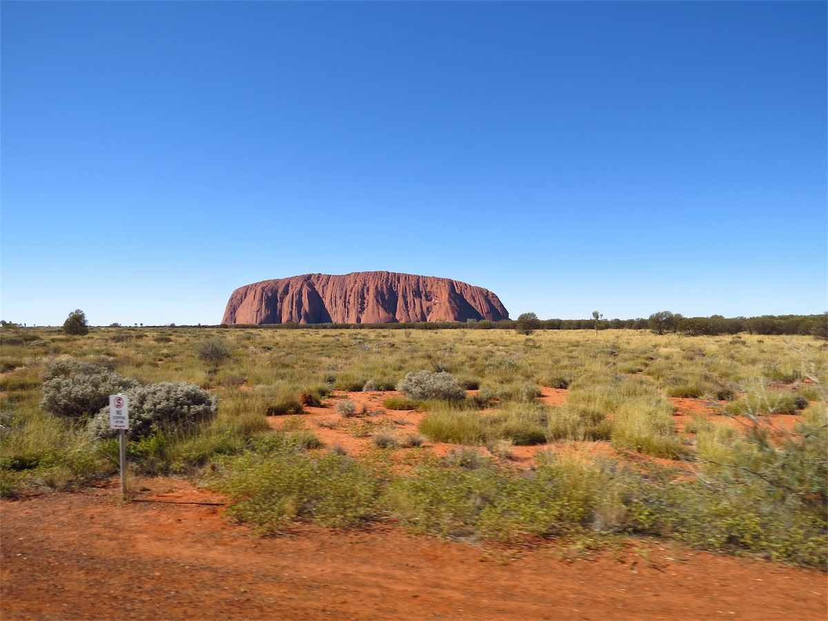
 We left the Olgas and continued on to Yulara. It wasn’t long before we caught sight of Ayers Rock. It definitely
has the WoW factor, made even more magnificent by the flat landscape surrounding it. The rich, red/brown rusty
colouring, is the result of oxidation, the weathering of iron-bearing minerals in the arkose (sandstone characterised
by an abundance of feldspar).
We left the Olgas and continued on to Yulara. It wasn’t long before we caught sight of Ayers Rock. It definitely
has the WoW factor, made even more magnificent by the flat landscape surrounding it. The rich, red/brown rusty
colouring, is the result of oxidation, the weathering of iron-bearing minerals in the arkose (sandstone characterised
by an abundance of feldspar).

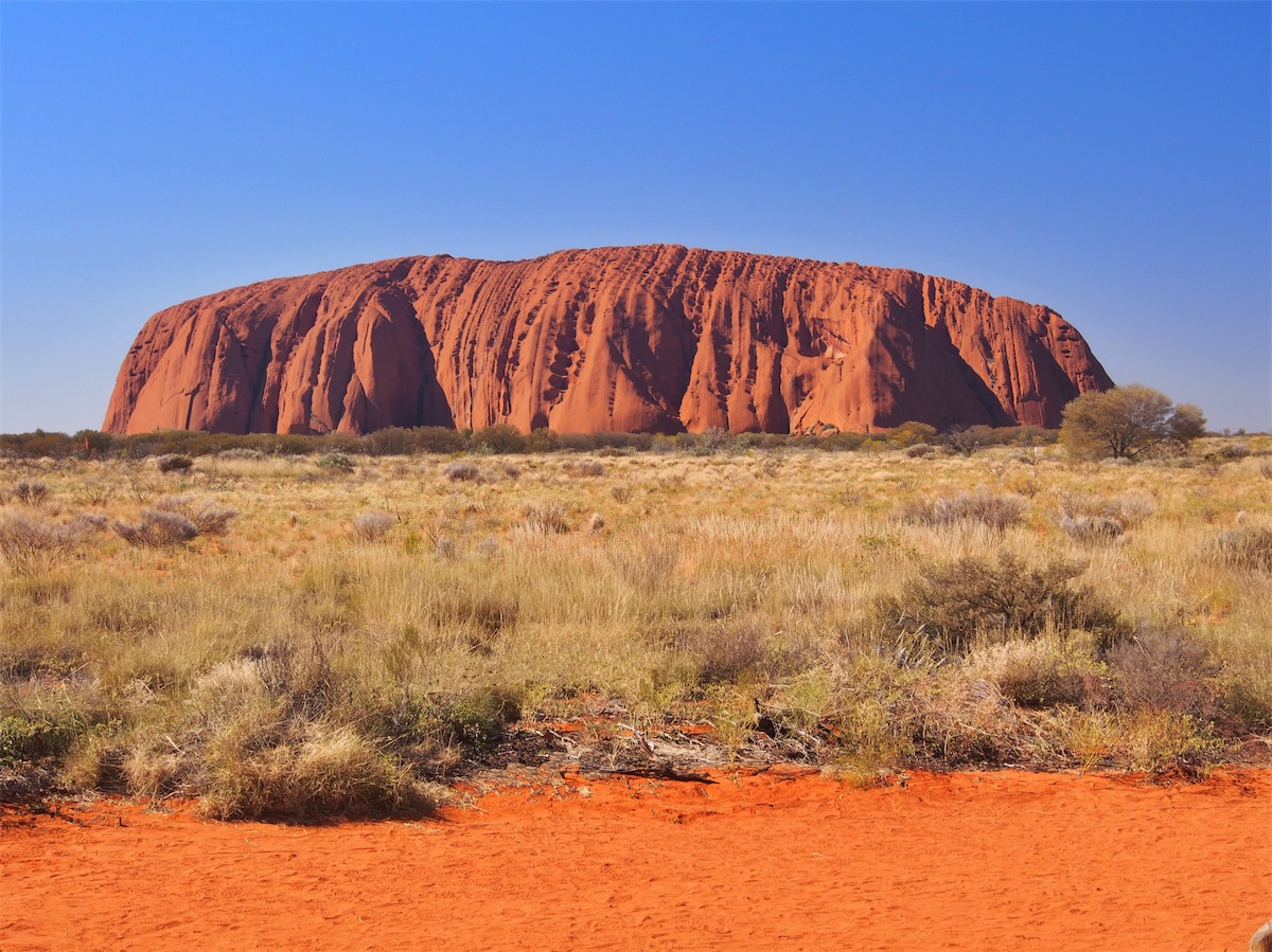
 The Olgas are a different composition to Ayers Rock, being made up of a conglomerate of pebbles, cobbles and
boulders of varying rock types including granite and basalt, cemented by a matrix of sandstone. Ayers Rock (Uluru)
is composed of layers of course grained sandstone rich in feldspar. Uluru is 348 meters with a circumference of 9.4km
but it’s mass is even larger underground.
The Olgas are a different composition to Ayers Rock, being made up of a conglomerate of pebbles, cobbles and
boulders of varying rock types including granite and basalt, cemented by a matrix of sandstone. Ayers Rock (Uluru)
is composed of layers of course grained sandstone rich in feldspar. Uluru is 348 meters with a circumference of 9.4km
but it’s mass is even larger underground.
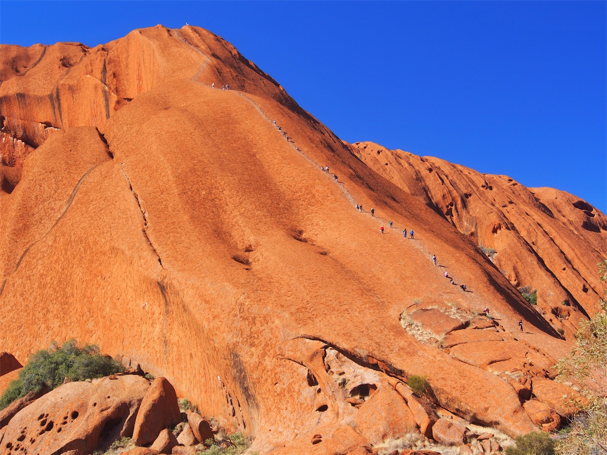
 Despite a request by the traditional owners because of the great spiritual significance of the Rock and also the concern
for the safety of those who climb it, there was still a line of people making their way to the top. It’s an impossibility for
visitors to this area to have the understanding of the significance that the Rock has to the local Indigenous people, so
unless the climbing of it is banned altogether people will continue to climb it. I believe there are moves afoot to have the
climbing of the Rock banned but it will be a brave Politician who initiates that ruling.
Despite a request by the traditional owners because of the great spiritual significance of the Rock and also the concern
for the safety of those who climb it, there was still a line of people making their way to the top. It’s an impossibility for
visitors to this area to have the understanding of the significance that the Rock has to the local Indigenous people, so
unless the climbing of it is banned altogether people will continue to climb it. I believe there are moves afoot to have the
climbing of the Rock banned but it will be a brave Politician who initiates that ruling.
 When I came through here with my Father many years ago, we stayed at a very basic Outback Motel that was situated
quite near Ayers Rock. The campground was also extremely basic and situated quite close as well. I was extremely
surprised then, when we headed for the campground and found it located near a large resort-style complex. The resort
itself was enormous and the crowds of people were staggering. But………..and this is coming from two people who are
not partial to crowds……………it is incredibly well done. The whole place has a wonderfully relaxed feel to it and is set
out in such a way that it is not over-whelming. It’s only when you walk around from one area to another that you realise
the extent of it. The Visitor’s Centre has one of the best displays and information of the local area that I have seen. It
was incredibly interesting and very informative.
When I came through here with my Father many years ago, we stayed at a very basic Outback Motel that was situated
quite near Ayers Rock. The campground was also extremely basic and situated quite close as well. I was extremely
surprised then, when we headed for the campground and found it located near a large resort-style complex. The resort
itself was enormous and the crowds of people were staggering. But………..and this is coming from two people who are
not partial to crowds……………it is incredibly well done. The whole place has a wonderfully relaxed feel to it and is set
out in such a way that it is not over-whelming. It’s only when you walk around from one area to another that you realise
the extent of it. The Visitor’s Centre has one of the best displays and information of the local area that I have seen. It
was incredibly interesting and very informative.
We had planned to spend only one night here but have opted for at least one more day to explore the area a bit. I would recommend this place to anyone wanting a really good place to go for a holiday. It is definitely on our list of places to come back to.
Sunday 24th August, Yalara, NT
A relaxing day just exploring the area.